Trail Walking Cassagnas - Le Plan de Fontmort par Magistravols - Cassagnas - Photo

Le Plan de Fontmort par Magistravols - Cassagnas

 tracegps
tracegps

User

© OpenStreetMap contributors
Length
Length
19.4 km
Max alt
Max alt
973 m
Uphill gradient
Uphill gradient
652 m
Km-Effort
Km-Effort  
28 km
Min alt
Min alt
696 m
Downhill gradient
Downhill gradient
651 m
Boucle
Boucle
Yes
Creation date :
2014-12-10 00:00:00.0
Updated on :
2014-12-10 00:00:00.0

(0 Reviews)

Walking
Walking
5h00
Difficulty : Difficult

Scan this QR Code to open this trail in the SityTrail application

FREE GPS app for hiking

Logo SityTrail SityTrail

IGN / Geographical institutes

Download SityTrail from the App Store Download SityTrail from Google Play

Logo SityTrail SityTrail World

The world is yours!

Download SityTrail from the App Store Download SityTrail from Google Play Download SityTrail on Huawei AppGallery

About

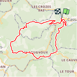
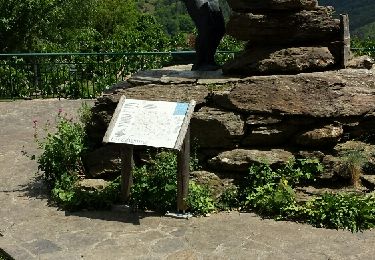
Trail Walking of 19.4 km to be discovered at Occitania, Lozère, Cassagnas. This trail is proposed by tracegps.

Description

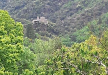
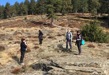
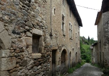
Belle balade en forêt avec le chant des oiseaux et des ruisseaux. Parking: ancienne gare de Cassagnas au bord de la Mimente (demander autorisation privé!!). Ne pas prendre le pont mais suivre la route avec GR72, puis virage à droite, quitter le GR pour une petite route montant à Magistavols. Fin du goudron. Traverser le hameau en suivant les indications du "PNC" et atteindre un col (cairn en forme de tour), continuer dans la même direction pour rejoindre un chemin sur la crête (panneaux indicateurs de rando du PNC), suivre barre des Cévennes aux carrefours direction "les quatre chemins". Prendre balisage équestre vers le sud puis l'est. Trouver une route, tourner à gauche et avant le hameau descendre à droite vers la rivière pour traverser à guet (attention suivant la saison!!). Remonter en suivant toujours le balisage équestre et gagner la route sur la crête. Suivre le GR qui longe la route en direction du plan de Fontmort. Traverser la route et suivre le GR70 vers Cassagnas (5.5km) et le parking.

Elevation profile

Photos

Positioning

Country:
France
Region :
Occitania
Department/Province :
Lozère
Municipality :
Cassagnas
Location:
Unknown
Start:(UTM)
558363 ; 4902267 (31T) N.

Trails nearby

Trail Walking Cassagnas - E10 Cassagnas - Lebou GR70 - Photo
Walking
GUIDE
Kargil

Walking

Medium
(1)
Cassagnas, Occitania, Lozère, France
22 km | 31 km-effort
5h 23min
No
Trail Walking Cassagnas - Etape 9 Cassagnas/St Étienne Vallée Française  - Photo
Walking
Nathalie. Mercier

Walking

Difficult
Cassagnas, Occitania, Lozère, France
26 km | 35 km-effort
6h 13min
No
Trail On foot Saint-Germain-de-Calberte - La Flandonenque - Photo
On foot
PRO

On foot

Easy
Saint-Germain-de-Calberte, Occitania, Lozère, France
9.2 km | 13.1 km-effort
2h 57min
Yes
Trail Walking Saint-Martin-de-Lansuscle - GR_70_AK_11_St-Martin-Lansuscle_St-Etienne-Vallee_20140925 - Photo
Walking
patrickdanilo

Walking

Easy
Saint-Martin-de-Lansuscle, Occitania, Lozère, France
19 km | 25 km-effort
5h 11min
No
Trail Walking Cassagnas - Cassagnas - Saint germain  - Photo
Walking
ploizon

Walking

Medium
Cassagnas, Occitania, Lozère, France
18.7 km | 26 km-effort
4h 45min
No
Trail Walking Cassagnas - etape 5 - Photo
Walking
gb88270

Walking

Easy
Cassagnas, Occitania, Lozère, France
19.8 km | 35 km-effort
5h 39min
No
Trail Walking Saint-Martin-de-Lansuscle - Le Cauvel  Lébou Stevenson - Photo
Walking
kephas

Walking

Medium
Saint-Martin-de-Lansuscle, Occitania, Lozère, France
20 km | 28 km-effort
5h 40min
No
Trail Walking Saint-Martin-de-Lansuscle - mas de Cauvel St jean du Gard - Photo
Walking
manginpascale

Walking

Very easy
Saint-Martin-de-Lansuscle, Occitania, Lozère, France
35 km | 49 km-effort
8h 57min
No
Trail Walking Cassagnas - Chemin de Stevenson - Cassagnas vers St Germain de Calberte - Photo
Walking
tracegps

Walking

Difficult
(1)
Cassagnas, Occitania, Lozère, France
14.9 km | 21 km-effort
3h 49min
No


Close
My subscriptions