Trail Walking Rochefort-en-Yvelines - Entre Rochefort en Yvelines,  St Arnoult et Clairefontaine - Photo

Entre Rochefort en Yvelines, St Arnoult et Clairefontaine

 tracegps
tracegps

User

© OpenStreetMap contributors
Length
Length
25 km
Max alt
Max alt
173 m
Uphill gradient
Uphill gradient
290 m
Km-Effort
Km-Effort  
29 km
Min alt
Min alt
102 m
Downhill gradient
Downhill gradient
289 m
Boucle
Boucle
Yes
Creation date :
2014-12-10 00:00:00.0
Updated on :
2014-12-10 00:00:00.0

(2 Reviews)

Walking
Walking
5h30
Difficulty : Medium

Scan this QR Code to open this trail in the SityTrail application

FREE GPS app for hiking

Logo SityTrail SityTrail

IGN / Geographical institutes

Download SityTrail from the App Store Download SityTrail from Google Play

Logo SityTrail SityTrail World

The world is yours!

Download SityTrail from the App Store Download SityTrail from Google Play Download SityTrail on Huawei AppGallery

About

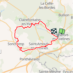
Trail Walking of 25 km to be discovered at Ile-de-France, Yvelines, Rochefort-en-Yvelines. This trail is proposed by tracegps.

Description

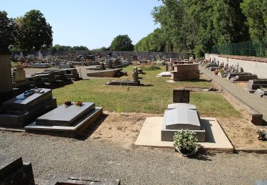
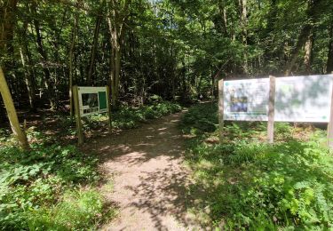
Au départ des environs de Rochefort en Yvelines, route de Clairefontaine, ce circuit rejoint la Rémarde avant de traverser Saint Arnoult. Il longe le domaine d'Aragon et d'Elsa Triolet puis continue à remonter la vallée de la Rémarde. A proximité de Sonchamp, il passe devant le château de Pinceloup, puis rejoint Clairefontaine, avant de reprendre la direction de Rochefort.

Elevation profile

Photos

Positioning

Country:
France
Region :
Ile-de-France
Department/Province :
Yvelines
Municipality :
Rochefort-en-Yvelines
Location:
Unknown
Start:(UTM)
424839 ; 5381921 (31U) N.

Comments

Please log in to post a review or rate the element


rando avec moyenne. trop de voiture .


Superbe randonnee.


Trails nearby

Trail Walking Bonnelles - _Le rallye de Bonnelles à Rochefort - Photo
Walking
GUIDE+

Walking

Medium
(10)
Bonnelles, Ile-de-France, Yvelines, France
14.1 km | 16.4 km-effort
3h 30min
Yes
Trail Walking Longvilliers - _Les Moulins de la Rémarde - Photo
Walking
GUIDE+

Walking

Easy
(7)
Longvilliers, Ile-de-France, Yvelines, France
9.3 km | 10.4 km-effort
2h 0min
Yes
Trail Walking Bullion - _Bullion, village vivant ! - Photo
Walking
GUIDE+

Walking

Very easy
(5)
Bullion, Ile-de-France, Yvelines, France
7.1 km | 8.5 km-effort
1h 52min
Yes
Trail Walking Bullion - _Le bois d''Haumont - Photo
Walking
GUIDE+

Walking

Easy
(4)
Bullion, Ile-de-France, Yvelines, France
5.8 km | 7.1 km-effort
1h 30min
Yes
Trail On foot Dourdan - Promenade de Nemours - Photo
On foot
PRO

On foot

Easy
Dourdan, Ile-de-France, Essonne, France
4.5 km | 4.9 km-effort
1h 6min
No
Trail Mountain bike Bonnelles - Bonnelle - Photo
Mountain bike
jfcontour

Mountain bike

Easy
(1)
Bonnelles, Ile-de-France, Yvelines, France
52 km | 61 km-effort
Unknown
Yes
Trail Walking Dourdan - Ste Mesme St Martin de Brethencourt - Photo
Walking
raivavae

Walking

Medium
(2)
Dourdan, Ile-de-France, Essonne, France
14.9 km | 17.5 km-effort
5min
Yes
Trail Walking Dourdan - R2-Dourdan et sa forêt - Photo
Walking
CSR-94

Walking

Very difficult
(1)
Dourdan, Ile-de-France, Essonne, France
19.3 km | 24 km-effort
5h 23min
Yes
Trail Walking Bonnelles - Yvelines_RD_Bonnelles - Photo
Walking
BMorin91470

Walking

Easy
Bonnelles, Ile-de-France, Yvelines, France
8.2 km | 9.4 km-effort
2h 8min
Yes


Close
My subscriptions