Boucle le long de l'Aveyron - Najac nord

tracegps
User
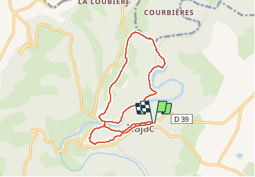

Length
8.3 km

Max alt
356 m

Uphill gradient
327 m
Km-Effort
12.7 km

Min alt
192 m

Downhill gradient
327 m
Boucle
Yes
Creation date :
2014-12-10 00:00:00.0
Updated on :
2014-12-10 00:00:00.0
2h00
Difficulty : Difficult

FREE GPS app for hiking
 SityTrail
IGN / Geographical institutes
SityTrail Plus
The world is yours!
About
Trail Walking of 8.3 km to be discovered at Occitania, Aveyron, Najac. This trail is proposed by tracegps.
Description
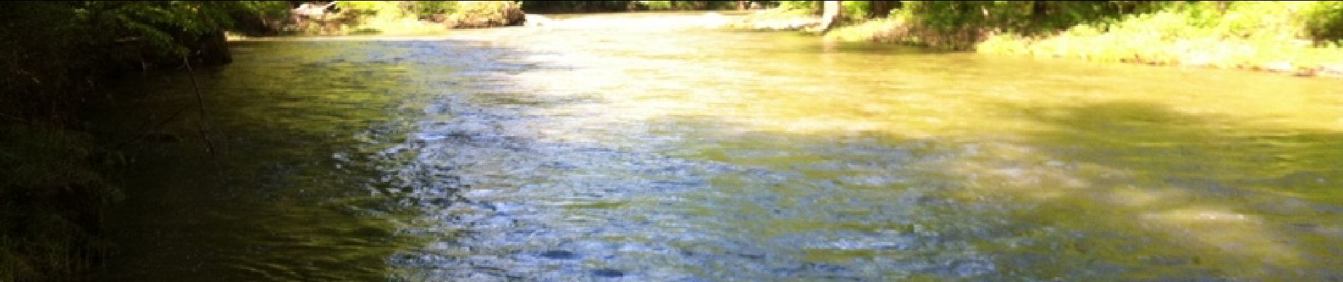
Départ de la gendarmerie, prendre la direction du centre du village, descendre au bord de l'Aveyron pour une belle boucle le long de la rivière.
Photos


Positioning
Country:
France
Region :
Occitania
Department/Province :
Aveyron
Municipality :
Najac
Location:
Unknown
Start:(Dec)
Start:(UTM)
418876 ; 4896923 (31T) N.
Comments