Trail Walking Najac - Vallée de L'Aveyron - Najac - Photo

Vallée de L'Aveyron - Najac

 tracegps
tracegps

User

© OpenStreetMap contributors
Length
Length
11.5 km
Max alt
Max alt
399 m
Uphill gradient
Uphill gradient
327 m
Km-Effort
Km-Effort  
15.9 km
Min alt
Min alt
187 m
Downhill gradient
Downhill gradient
324 m
Boucle
Boucle
Yes
Creation date :
2014-12-10 00:00:00.0
Updated on :
2014-12-10 00:00:00.0

(1 Reviews)

Walking
Walking
2h30
Difficulty : Difficult

Scan this QR Code to open this trail in the SityTrail application

FREE GPS app for hiking

Logo SityTrail SityTrail

IGN / Geographical institutes

Download SityTrail from the App Store Download SityTrail from Google Play

Logo SityTrail SityTrail World

The world is yours!

Download SityTrail from the App Store Download SityTrail from Google Play Download SityTrail on Huawei AppGallery

About

Trail Walking of 11.5 km to be discovered at Occitania, Aveyron, Najac. This trail is proposed by tracegps.

Description

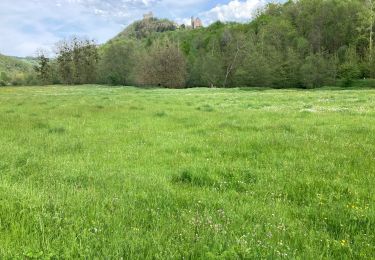
Départ de la salle des fêtes derrière la gendarmerie. Prendre vers le sud par le sentier où vous pouvez admirer le château de Najac.

Elevation profile

Photos

Positioning

Country:
France
Region :
Occitania
Department/Province :
Aveyron
Municipality :
Najac
Location:
Unknown
Start:(UTM)
418945 ; 4896900 (31T) N.

Comments

Please log in to post a review or rate the element


Fait avec Bene 15/08/15


Trails nearby

Trail Walking Najac - Boucle le long de l'Aveyron - Najac nord - Photo
Walking
tracegps

Walking

Difficult
(1)
Najac, Occitania, Aveyron, France
8.3 km | 12.7 km-effort
2h 0min
Yes
Trail Walking Najac - Autour de Najac par le village Vacances Bleues et Cassagnes - Photo
Walking
swp648

Walking

Medium
Najac, Occitania, Aveyron, France
13.2 km | 17.8 km-effort
5h 4min
Yes
Trail Walking Najac - boucle najac - Photo
Walking
fab0202

Walking

Very easy
Najac, Occitania, Aveyron, France
12.6 km | 0 m-effort
4h 11min
Yes
Trail Cycle Najac - Circuit des 10 plus beaux villages de France de l'Aveyron - Najac - Capdenac - Photo
Cycle
tracegps

Cycle

Difficult
Najac, Occitania, Aveyron, France
110 km | 136 km-effort
6h 0min
No
Trail Walking Najac - Aveyron-121014 - Najac-Cassagnes (txt,gps,foto) - Photo
Walking
randodan

Walking

Very easy
Najac, Occitania, Aveyron, France
14.3 km | 19 km-effort
5h 30min
Yes
Trail Walking Najac - Najac - Photo
Walking
jpblimond

Walking

Medium
Najac, Occitania, Aveyron, France
14.7 km | 20 km-effort
4h 52min
No
Trail Walking Najac - Du vvf à l’Aveyron  - Photo
Walking
carolineF11

Walking

Difficult
Najac, Occitania, Aveyron, France
6.8 km | 10 km-effort
2h 13min
Yes
Trail Walking Najac - najac - Photo
Walking
Paulodst

Walking

Very easy
Najac, Occitania, Aveyron, France
14.2 km | 19.9 km-effort
4h 11min
Yes
Trail Walking Najac - najac - Photo
Walking
Paulodst

Walking

Very easy
Najac, Occitania, Aveyron, France
14.2 km | 19.9 km-effort
4h 11min
Yes


Close
My subscriptions