


Cordemais 2012-05-26

phila128
User
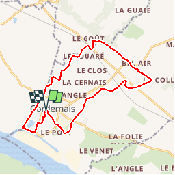

Length
15.7 km

Max alt
35 m

Uphill gradient
114 m
Km-Effort
17.2 km

Min alt
-2 m

Downhill gradient
114 m
Boucle
Yes
Creation date :
2014-12-10 00:00:00.0
Updated on :
2014-12-10 00:00:00.0
2h58
Difficulty : Medium

FREE GPS app for hiking
 SityTrail
IGN / Geographical institutes
SityTrail Plus
The world is yours!
About
Trail Walking of 15.7 km to be discovered at Pays de la Loire, Loire-Atlantique, Cordemais. This trail is proposed by phila128.
Description
Boucle du marais
Fléchage en bleu
Positioning
Country:
France
Region :
Pays de la Loire
Department/Province :
Loire-Atlantique
Municipality :
Cordemais
Location:
Unknown
Start:(Dec)
Start:(UTM)
584758 ; 5238002 (30T) N.
Comments