


le rulhe - merens

xav34830
User
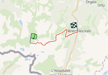

Length
13.5 km

Max alt
2427 m

Uphill gradient
506 m
Km-Effort
24 km

Min alt
1060 m

Downhill gradient
1636 m
Boucle
No
Creation date :
2014-12-10 00:00:00.0
Updated on :
2014-12-10 00:00:00.0
--
Difficulty : Difficult

FREE GPS app for hiking
 SityTrail
IGN / Geographical institutes
SityTrail Plus
The world is yours!
About
Trail Walking of 13.5 km to be discovered at Occitania, Ariège, Aston. This trail is proposed by xav34830.
Positioning
Country:
France
Region :
Occitania
Department/Province :
Ariège
Municipality :
Aston
Location:
Unknown
Start:(Dec)
Start:(UTM)
395546 ; 4721410 (31T) N.
Comments