


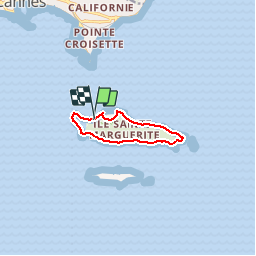
tour de l'ile sainte-marguerite

davidl03
User

Length
7.6 km

Max alt
39 m

Uphill gradient
99 m
Km-Effort
8.9 km

Min alt
-1 m

Downhill gradient
100 m
Boucle
Yes
Creation date :
2014-12-10 00:00:00.0
Updated on :
2014-12-10 00:00:00.0
2h00
Difficulty : Easy

FREE GPS app for hiking
 SityTrail
IGN / Geographical institutes
SityTrail Plus
The world is yours!
About
Trail Walking of 7.6 km to be discovered at Provence-Alpes-Côte d'Azur, Maritime Alps, Cannes. This trail is proposed by davidl03.
Positioning
Country:
France
Region :
Provence-Alpes-Côte d'Azur
Department/Province :
Maritime Alps
Municipality :
Cannes
Location:
Unknown
Start:(Dec)
Start:(UTM)
341508 ; 4820639 (32T) N.
Comments
Pas de possibilité de GPS ITINÉRAIRE_ type MAPSVOIR LES CARTES SANS GPS