


Aziré

olaze
User
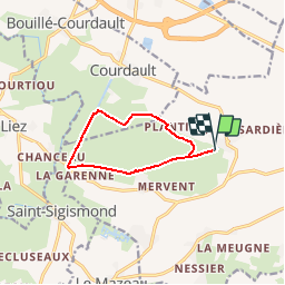

Length
9 km

Max alt
9 m

Uphill gradient
49 m
Km-Effort
9.6 km

Min alt
0 m

Downhill gradient
48 m
Boucle
Yes
Creation date :
2014-12-10 00:00:00.0
Updated on :
2014-12-10 00:00:00.0
--
Difficulty : Easy

FREE GPS app for hiking
 SityTrail
IGN / Geographical institutes
SityTrail Plus
The world is yours!
About
Trail Walking of 9 km to be discovered at Pays de la Loire, Vendée, Benet. This trail is proposed by olaze.
Description
Rando ATSCAF79:
Promenade dans le marais, la campagne,le canal de Courdault, la rigole d'Aziré.
Départ & retour du port d'Aziré
Positioning
Country:
France
Region :
Pays de la Loire
Department/Province :
Vendée
Municipality :
Benet
Location:
Unknown
Start:(Dec)
Start:(UTM)
681420 ; 5137213 (30T) N.
Comments