


chaumard

kronio
User

Length
10.2 km

Max alt
367 m

Uphill gradient
111 m
Km-Effort
11.7 km

Min alt
288 m

Downhill gradient
119 m
Boucle
Yes
Creation date :
2014-12-10 00:00:00.0
Updated on :
2014-12-10 00:00:00.0
--
Difficulty : Medium

FREE GPS app for hiking
 SityTrail
IGN / Geographical institutes
SityTrail Plus
The world is yours!
About
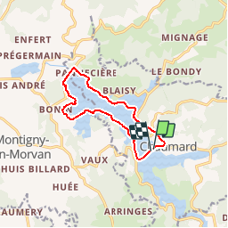
Trail Walking of 10.2 km to be discovered at Bourgogne-Franche-Comté, Nièvre, Chaumard. This trail is proposed by kronio.
Description
fete de la randonn�e le 17 06 2012


Positioning
Country:
France
Region :
Bourgogne-Franche-Comté
Department/Province :
Nièvre
Municipality :
Chaumard
Location:
Unknown
Start:(Dec)
Start:(UTM)
568707 ; 5221558 (31T) N.
Comments