


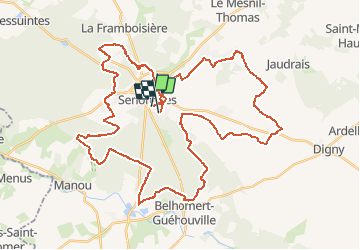

5.3 km | 6.1 km-effort


User


FREE GPS app for hiking
 SityTrail
IGN / Geographical institutes
SityTrail World
The world is yours!
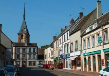
Trail Mountain bike of 51 km to be discovered at Centre-Loire Valley, Eure-et-Loir, Senonches. This trail is proposed by tracegps.
Randonnée du 20 mai 2012 en forêt de Senonches facile par temps sec avec une boucle de 20 km en partie sur route et chemin herbeux pas très intéressante.

![Trail On foot Senonches - [Itinéraire] En pays senonchois - Photo](https://media.geolcdn.com/t/375/260/ext.jpg?maxdim=2&url=https%3A%2F%2Fmedia.geolcdn.com%2Ff%2F61bc1a20-8230-4087-9a08-2621b726d935.jpeg)
On foot

Walking
Equestrian
Mountain bike

Walking

Mountain bike
Walking

Walking
Walking