


Sources Rennes les bains

patbt
User
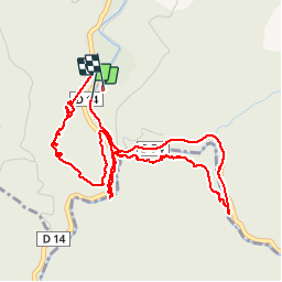

Length
5.8 km

Max alt
440 m

Uphill gradient
213 m
Km-Effort
8.7 km

Min alt
310 m

Downhill gradient
217 m
Boucle
Yes
Creation date :
2014-12-10 00:00:00.0
Updated on :
2014-12-10 00:00:00.0
3h05
Difficulty : Medium

FREE GPS app for hiking
 SityTrail
IGN / Geographical institutes
SityTrail Plus
The world is yours!
About
Trail Walking of 5.8 km to be discovered at Occitania, Aude, Rennes-les-Bains. This trail is proposed by patbt.
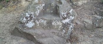
Photos


Positioning
Country:
France
Region :
Occitania
Department/Province :
Aude
Municipality :
Rennes-les-Bains
Location:
Unknown
Start:(Dec)
Start:(UTM)
444313 ; 4751338 (31T) N.
Comments
Excellent