


Lac de Bassia

pmauvieux
User

Length
19.8 km

Max alt
2283 m

Uphill gradient
1315 m
Km-Effort
37 km

Min alt
1009 m

Downhill gradient
1325 m
Boucle
No
Creation date :
2018-08-14 20:35:44.662
Updated on :
2018-08-14 20:35:44.747
8h22
Difficulty : Difficult

FREE GPS app for hiking
 SityTrail
IGN / Geographical institutes
SityTrail Plus
The world is yours!
About
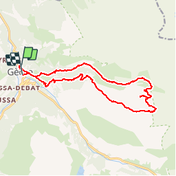
Trail Walking of 19.8 km to be discovered at Occitania, Hautespyrenees, Gavarnie-Gèdre. This trail is proposed by pmauvieux.
Positioning
Country:
France
Region :
Occitania
Department/Province :
Hautespyrenees
Municipality :
Gavarnie-Gèdre
Location:
Gèdre
Start:(Dec)
Start:(UTM)
256229 ; 4741754 (31T) N.
Comments