


senart

serge.rougerie
User

Length
6.9 km

Max alt
97 m

Uphill gradient
45 m
Km-Effort
7.5 km

Min alt
81 m

Downhill gradient
40 m
Boucle
Yes
Creation date :
2014-12-10 00:00:00.0
Updated on :
2014-12-10 00:00:00.0
1h18
Difficulty : Unknown

FREE GPS app for hiking
 SityTrail
IGN / Geographical institutes
SityTrail Plus
The world is yours!
About
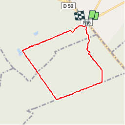
Trail Walking of 6.9 km to be discovered at Ile-de-France, Essonne, Montgeron. This trail is proposed by serge.rougerie.
Positioning
Country:
France
Region :
Ile-de-France
Department/Province :
Essonne
Municipality :
Montgeron
Location:
Unknown
Start:(Dec)
Start:(UTM)
462445 ; 5392308 (31U) N.
Comments