


roc des ecus

yt34
User
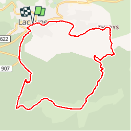

Length
11.9 km

Max alt
1164 m

Uphill gradient
466 m
Km-Effort
18.1 km

Min alt
797 m

Downhill gradient
467 m
Boucle
Yes
Creation date :
2014-12-10 00:00:00.0
Updated on :
2014-12-10 00:00:00.0
3h45
Difficulty : Easy

FREE GPS app for hiking
 SityTrail
IGN / Geographical institutes
SityTrail Plus
The world is yours!
About
Trail Walking of 11.9 km to be discovered at Occitania, Tarn, Lacaune. This trail is proposed by yt34.
Description
Randonnée Solher du 24/07/2012


Positioning
Country:
France
Region :
Occitania
Department/Province :
Tarn
Municipality :
Lacaune
Location:
Unknown
Start:(Dec)
Start:(UTM)
475106 ; 4839363 (31T) N.
Comments