Trespoux (circuit)

poupartbertrand
User
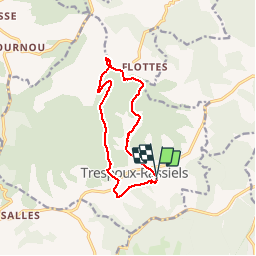

Length
11.7 km

Max alt
332 m

Uphill gradient
258 m
Km-Effort
15.1 km

Min alt
156 m

Downhill gradient
253 m
Boucle
Yes
Creation date :
2014-12-10 00:00:00.0
Updated on :
2014-12-10 00:00:00.0
2h00
Difficulty : Medium

FREE GPS app for hiking
 SityTrail
IGN / Geographical institutes
SityTrail Plus
The world is yours!
About
Trail Walking of 11.7 km to be discovered at Occitania, Lot, Trespoux-Rassiels. This trail is proposed by poupartbertrand.
Description
BALISAGE JAUNE
Pas de difficulté particulière. Alternance de marche à découvert et en sous-bois.
Départ depuis l'église de Trespoux.
Positioning
Country:
France
Region :
Occitania
Department/Province :
Lot
Municipality :
Trespoux-Rassiels
Location:
Unknown
Start:(Dec)
Start:(UTM)
370850 ; 4918895 (31T) N.
Comments