


Telgruc sur mer

gilsep
User

Length
4.6 km

Max alt
42 m

Uphill gradient
68 m
Km-Effort
5.4 km

Min alt
2 m

Downhill gradient
65 m
Boucle
Yes
Creation date :
2014-12-10 00:00:00.0
Updated on :
2014-12-10 00:00:00.0
45m
Difficulty : Very easy

FREE GPS app for hiking
 SityTrail
IGN / Geographical institutes
SityTrail Plus
The world is yours!
About
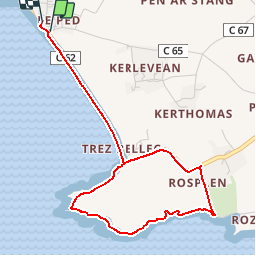
Trail Walking of 4.6 km to be discovered at Brittany, Finistère, Telgruc-sur-Mer. This trail is proposed by gilsep.
Positioning
Country:
France
Region :
Brittany
Department/Province :
Finistère
Municipality :
Telgruc-sur-Mer
Location:
Unknown
Start:(Dec)
Start:(UTM)
397860 ; 5341342 (30U) N.
Comments