


Labastide Marnhac - Montcuq

poupartbertrand
User
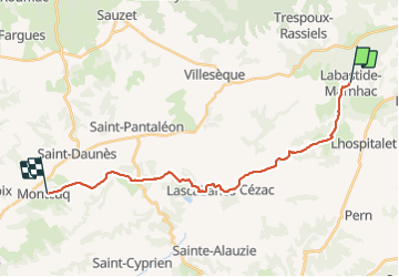

Length
21 km

Max alt
304 m

Uphill gradient
251 m
Km-Effort
25 km

Min alt
177 m

Downhill gradient
356 m
Boucle
No
Creation date :
2014-12-10 00:00:00.0
Updated on :
2014-12-10 00:00:00.0
3h55
Difficulty : Medium

FREE GPS app for hiking
 SityTrail
IGN / Geographical institutes
SityTrail Plus
The world is yours!
About
Trail Walking of 21 km to be discovered at Occitania, Lot, Labastide-Marnhac. This trail is proposed by poupartbertrand.
Description
Gr65
Positioning
Country:
France
Region :
Occitania
Department/Province :
Lot
Municipality :
Labastide-Marnhac
Location:
Unknown
Start:(Dec)
Start:(UTM)
372472 ; 4916172 (31T) N.
Comments