


Fontainebleau 2012

rafa77
User
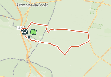

Length
14.2 km

Max alt
142 m

Uphill gradient
111 m
Km-Effort
15.7 km

Min alt
73 m

Downhill gradient
113 m
Boucle
Yes
Creation date :
2014-12-10 00:00:00.0
Updated on :
2014-12-10 00:00:00.0
--
Difficulty : Easy

FREE GPS app for hiking
 SityTrail
IGN / Geographical institutes
SityTrail Plus
The world is yours!
About
Trail Walking of 14.2 km to be discovered at Ile-de-France, Seine-et-Marne, Noisy-sur-École. This trail is proposed by rafa77.
Description
Rando GHA Fontainebleau 2012
Positioning
Country:
France
Region :
Ile-de-France
Department/Province :
Seine-et-Marne
Municipality :
Noisy-sur-École
Location:
Unknown
Start:(Dec)
Start:(UTM)
467683 ; 5359407 (31U) N.
Comments