


GR TMB 08

mazelpat
User

Length
16 km

Max alt
2207 m

Uphill gradient
1188 m
Km-Effort
34 km

Min alt
1328 m

Downhill gradient
1713 m
Boucle
No
Creation date :
2014-12-10 00:00:00.0
Updated on :
2014-12-10 00:00:00.0
--
Difficulty : Unknown

FREE GPS app for hiking
 SityTrail
IGN / Geographical institutes
SityTrail Plus
The world is yours!
About
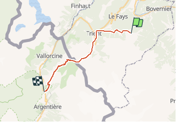
Trail Other activity of 16 km to be discovered at Valais/Wallis, Martigny, Martigny-Combe. This trail is proposed by mazelpat.
Description
Etape 8 : Bovine - Tré le Champ
Positioning
Country:
Switzerland
Region :
Valais/Wallis
Department/Province :
Martigny
Municipality :
Martigny-Combe
Location:
Unknown
Start:(Dec)
Start:(UTM)
348931 ; 5102067 (32T) N.
Comments