


agout

yt34
User
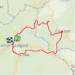

Length
18.3 km

Max alt
1010 m

Uphill gradient
531 m
Km-Effort
25 km

Min alt
770 m

Downhill gradient
527 m
Boucle
Yes
Creation date :
2014-12-10 00:00:00.0
Updated on :
2014-12-10 00:00:00.0
4h11
Difficulty : Medium

FREE GPS app for hiking
 SityTrail
IGN / Geographical institutes
SityTrail Plus
The world is yours!
About
Trail Walking of 18.3 km to be discovered at Occitania, Hérault, Fraisse-sur-Agout. This trail is proposed by yt34.
Positioning
Country:
France
Region :
Occitania
Department/Province :
Hérault
Municipality :
Fraisse-sur-Agout
Location:
Unknown
Start:(Dec)
Start:(UTM)
483830 ; 4828152 (31T) N.
Comments