Trail Mountain bike Lasserre-Pradère - Lasserre - Leguevin (Place du marché) - Photo

Lasserre - Leguevin (Place du marché)

© OpenStreetMap contributors
Length
Length
8.6 km
Max alt
Max alt
247 m
Uphill gradient
Uphill gradient
119 m
Km-Effort
Km-Effort  
10.2 km
Min alt
Min alt
176 m
Downhill gradient
Downhill gradient
104 m
Boucle
Boucle
No
Creation date :
2014-12-10 00:00:00.0
Updated on :
2014-12-10 00:00:00.0

(0 Reviews)

Mountain bike
Mountain bike
--
Difficulty : Easy

Scan this QR Code to open this trail in the SityTrail application

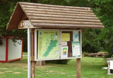
FREE GPS app for hiking

Logo SityTrail SityTrail

IGN / Geographical institutes

Download SityTrail from the App Store Download SityTrail from Google Play

Logo SityTrail SityTrail World

The world is yours!

Download SityTrail from the App Store Download SityTrail from Google Play Download SityTrail on Huawei AppGallery

About

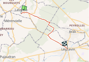
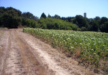
Trail Mountain bike of 8.6 km to be discovered at Occitania, Haute-Garonne, Lasserre-Pradère. This trail is proposed by Mamicharge.

Description

Lasserre Leguevin(Place du marché en empruntant essentiellement piste cyclable.

Elevation profile

Points of interest

Point of interest Lasserre-Pradère - Parking Maison Forestière - Photo
Mamicharge
LASSERRE-PRADÈRE 
Point of interest Lasserre-Pradère - Muret. - Photo
Mamicharge
LASSERRE-PRADÈRE 
Point of interest Léguevin - Entrée piste Cyclable - Photo
Mamicharge
Point of interest Léguevin - Chateau d'Eau - Photo
Mamicharge
LÉGUEVIN 

Positioning

Country:
France
Region :
Occitania
Department/Province :
Haute-Garonne
Municipality :
Lasserre-Pradère
Location:
Unknown
Start:(UTM)
352272 ; 4832962 (31T) N.

Trails nearby

Trail Mountain bike Montaigut-sur-Save - Espace VTT FFC de Bouconne- Circuit n° 3 - Forêt de Bouconne - Photo
Mountain bike
tracegps

Mountain bike

Difficult
(1)
Montaigut-sur-Save, Occitania, Haute-Garonne, France
31 km | 36 km-effort
3h 0min
Yes
Trail On foot Pujaudran - Circuit de la Forêt de Lartus - Photo
On foot
PRO

On foot

Easy
Pujaudran, Occitania, Gers, France
9.7 km | 12.4 km-effort
2h 49min
Yes
Trail Walking Lévignac - Bouconne Mondou - Photo
Walking
zazibelle

Walking

Easy
(1)
Lévignac, Occitania, Haute-Garonne, France
8.8 km | 9.9 km-effort
2h 17min
Yes
Trail Mountain bike Montaigut-sur-Save - Forêt de Bouconne - Photo
Mountain bike
tracegps

Mountain bike

Difficult
Montaigut-sur-Save, Occitania, Haute-Garonne, France
41 km | 46 km-effort
3h 0min
Yes
Trail Running Pujaudran - Trois étoiles à Pujaudran - Photo
Running
tracegps

Running

Difficult
Pujaudran, Occitania, Gers, France
18.9 km | 23 km-effort
2h 0min
Yes
Trail Walking Pujaudran - Trois étoiles à Pujaudran - Photo
Walking
tracegps

Walking

Difficult
Pujaudran, Occitania, Gers, France
18.9 km | 23 km-effort
3h 49min
Yes
Trail Running Menville - Crêtes salées - Photo
Running
tracegps

Running

Difficult
Menville, Occitania, Haute-Garonne, France
13.9 km | 17.9 km-effort
1h 30min
Yes
Trail Mountain bike Menville - Crêtes salées - Photo
Mountain bike
tracegps

Mountain bike

Easy
Menville, Occitania, Haute-Garonne, France
13.9 km | 17.9 km-effort
1h 0min
Yes
Trail Walking Menville - Crêtes salées - Photo
Walking
tracegps

Walking

Medium
Menville, Occitania, Haute-Garonne, France
13.9 km | 17.9 km-effort
2h 49min
Yes


Close
My subscriptions