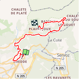
9 km | 14.3 km-effort
grimpe de chedde ayeres
winbat11
User
Length
15 km
Max alt
1635 m
Uphill gradient
1187 m
Km-Effort
28 km
Min alt
599 m
Downhill gradient
435 m
Boucle
No
Creation date :
2014-12-10 00:00:00.0
Updated on :
2014-12-10 00:00:00.0
2h46
Difficulty : Unknown
FREE GPS app for hiking
About
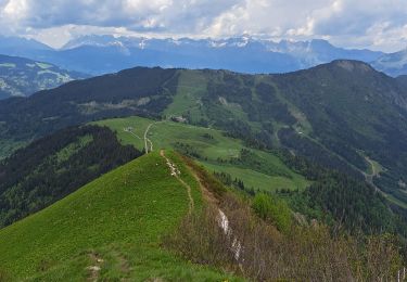
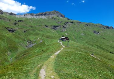
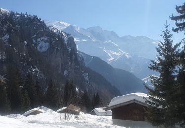
Trail Running of 15 km to be discovered at Auvergne-Rhône-Alpes, Upper Savoy, Passy. This trail is proposed by winbat11.
Description
trail
Positioning
Country:
France
Region :
Auvergne-Rhône-Alpes
Department/Province :
Upper Savoy
Municipality :
Passy
Location:
Unknown
Start:(Dec)
Start:(UTM)
323287 ; 5088558 (32T) N.
Comments
Trails nearby
Tour des Ayères - Passy Plaine-Joux
Walking
Medium
(6)
Passy,
Auvergne-Rhône-Alpes,
Upper Savoy,
France
2h 30min
Yes
Plaine Joux Barmus Ayères Lac Vert
Walking
Very easy
(1)
Passy,
Auvergne-Rhône-Alpes,
Upper Savoy,
France
7.6 km | 12.2 km-effort
2h 18min
Yes
Tour de la chaine des Fiz par le passage du Dérochoir
Walking
Very difficult
(1)
Passy,
Auvergne-Rhône-Alpes,
Upper Savoy,
France
47 km | 90 km-effort
18h 0min
Yes
Plaine Joux-Passage du derochoir-Col de Portette-Platé
Walking
Difficult
Passy,
Auvergne-Rhône-Alpes,
Upper Savoy,
France
14.4 km | 30 km-effort
6h 42min
Yes
Chalets de Charlousse
Walking
Easy
(2)
Les Houches,
Auvergne-Rhône-Alpes,
Upper Savoy,
France
9.2 km | 14.1 km-effort
2h 28min
Yes
LE PRARION
Walking
Very difficult
Saint-Gervais-les-Bains,
Auvergne-Rhône-Alpes,
Upper Savoy,
France
12.3 km | 23 km-effort
5h 28min
Yes
Maison Neuve (Les Houches) boucle par Bellevue et Mont Lachat
Walking
Difficult
Les Houches,
Auvergne-Rhône-Alpes,
Upper Savoy,
France
13.6 km | 27 km-effort
4h 0min
Yes
SIXT PASSY RESERVE: PLAINE JOUX- LAC DE PORMENAZ - REFUGE DE MOEDE ANTERNE - ...
Walking
Difficult
Passy,
Auvergne-Rhône-Alpes,
Upper Savoy,
France
16.7 km | 28 km-effort
5h 34min
Yes
05-03-2022 Plaine Joux - Chalet du Souay
Snowshoes
Easy
Passy,
Auvergne-Rhône-Alpes,
Upper Savoy,
France
9.2 km | 15.2 km-effort
2h 41min
Yes
bonne application. par contre des fois un peu lente pour afficher la carte.