


Hameau du Cros

patrando49
User

Length
4.6 km

Max alt
1823 m

Uphill gradient
284 m
Km-Effort
8.4 km

Min alt
1546 m

Downhill gradient
285 m
Boucle
Yes
Creation date :
2014-12-10 00:00:00.0
Updated on :
2014-12-10 00:00:00.0
2h00
Difficulty : Easy

FREE GPS app for hiking
 SityTrail
IGN / Geographical institutes
SityTrail Plus
The world is yours!
About
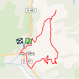
Trail Walking of 4.6 km to be discovered at Provence-Alpes-Côte d'Azur, Hautes-Alpes, Abriès-Ristolas. This trail is proposed by patrando49.
Description
Visite des ruines du Hameau du Cros au dessus d'Abries
Positioning
Country:
France
Region :
Provence-Alpes-Côte d'Azur
Department/Province :
Hautes-Alpes
Municipality :
Abriès-Ristolas
Location:
Unknown
Start:(Dec)
Start:(UTM)
336052 ; 4962279 (32T) N.
Comments