Trail Walking Villegusien-le-Lac - Heuilley-cotton - Cohons - Longeau - Photo

Heuilley-cotton - Cohons - Longeau

© OpenStreetMap contributors
Length
Length
17 km
Max alt
Max alt
457 m
Uphill gradient
Uphill gradient
252 m
Km-Effort
Km-Effort  
20 km
Min alt
Min alt
306 m
Downhill gradient
Downhill gradient
253 m
Boucle
Boucle
Yes
Creation date :
2014-12-10 00:00:00.0
Updated on :
2014-12-10 00:00:00.0

(1 Reviews)

Walking
Walking
4h00
Difficulty : Medium

Scan this QR Code to open this trail in the SityTrail application

FREE GPS app for hiking

Logo SityTrail SityTrail

IGN / Geographical institutes

Download SityTrail from the App Store Download SityTrail from Google Play

Logo SityTrail SityTrail World

The world is yours!

Download SityTrail from the App Store Download SityTrail from Google Play Download SityTrail on Huawei AppGallery

About

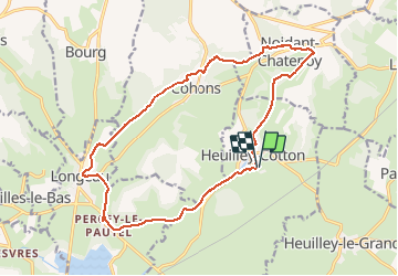
Trail Walking of 17 km to be discovered at Grand Est, Haute-Marne, Villegusien-le-Lac. This trail is proposed by indianalou.

Description

VTT possible
Vous découvrirez:
- une des entrées du tunnel de Balesmes (Canal Marne Saône).
- l'escargot de Cohons
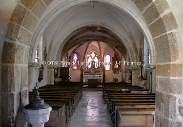
- le Château de Percey-le-Pautel
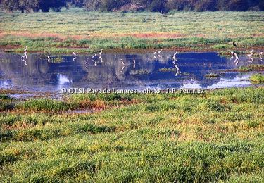
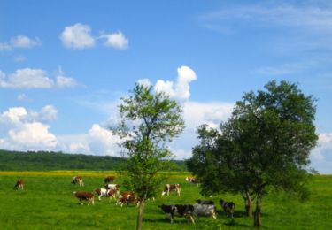
- balade en forêt
- balade en bord de canal
- ...
- points de vue très sympa !

Elevation profile

Positioning

Country:
France
Region :
Grand Est
Department/Province :
Haute-Marne
Municipality :
Villegusien-le-Lac
Location:
Unknown
Start:(UTM)
677246 ; 5293438 (31T) N.

Comments

Please log in to post a review or rate the element


Trails nearby

Trail Walking Longeau-Percey - Tour du Lac de la Vingeanne - Villegusien - Photo
Walking
tracegps

Walking

Easy
(2)
Longeau-Percey, Grand Est, Haute-Marne, France
8.6 km | 9.4 km-effort
1h 30min
Yes
Trail Walking Noidant-Chatenoy - source de la marne - Photo
Walking
richies77

Walking

Medium
Noidant-Chatenoy, Grand Est, Haute-Marne, France
16 km | 19.8 km-effort
4h 18min
Yes
Trail Mountain bike Saint-Broingt-le-Bois - La Via Francigena - Traversée de la Haute Marne -de St Boingt le Bois à Leffond - Photo
Mountain bike
tracegps

Mountain bike

Easy
Saint-Broingt-le-Bois, Grand Est, Haute-Marne, France
10.7 km | 12.9 km-effort
49min
No
Trail Walking Saint-Broingt-le-Bois - La Via Francigena - Traversée de la Haute Marne -de St Boingt le Bois à Leffond - Photo
Walking
tracegps

Walking

Medium
Saint-Broingt-le-Bois, Grand Est, Haute-Marne, France
10.7 km | 12.9 km-effort
2h 10min
No
Trail Mountain bike Longeau-Percey - Tour du Lac de la Vingeanne - Villegusien - Photo
Mountain bike
tracegps

Mountain bike

Easy
Longeau-Percey, Grand Est, Haute-Marne, France
8.6 km | 9.4 km-effort
45min
Yes
Trail Mountain bike Saint-Broingt-le-Bois - Le vallon de la Resaigne - St Broingt le Bois - Grandchamp - Photo
Mountain bike
tracegps

Mountain bike

Difficult
Saint-Broingt-le-Bois, Grand Est, Haute-Marne, France
14.2 km | 18 km-effort
2h 0min
Yes
Trail Walking Saint-Broingt-le-Bois - Le vallon de la Resaigne - St Broingt le Bois - Grandchamp - Photo
Walking
tracegps

Walking

Difficult
Saint-Broingt-le-Bois, Grand Est, Haute-Marne, France
14.2 km | 18 km-effort
4h 0min
Yes
Trail Walking Longeau-Percey - Tour du lac de Vingeanne - Photo
Walking
vvinzz

Walking

Easy
Longeau-Percey, Grand Est, Haute-Marne, France
9.2 km | 10.1 km-effort
2h 18min
Yes
Trail Motor Bourg - a-frankrijk-hobbelig-achteraf-in-dijon - Photo
Motor
gpstracks

Motor

Very easy
Bourg, Grand Est, Haute-Marne, France
56 km | 72 km-effort
Unknown
Yes


Close
My subscriptions