2012-06-17 16h03m19la souche

Michel07
User
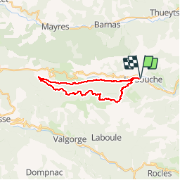

Length
22 km

Max alt
1244 m

Uphill gradient
957 m
Km-Effort
35 km

Min alt
526 m

Downhill gradient
955 m
Boucle
Yes
Creation date :
2014-12-10 00:00:00.0
Updated on :
2014-12-10 00:00:00.0
5h17
Difficulty : Difficult

FREE GPS app for hiking
 SityTrail
IGN / Geographical institutes
SityTrail Plus
The world is yours!
About
Trail Walking of 22 km to be discovered at Auvergne-Rhône-Alpes, Ardèche, La Souche. This trail is proposed by Michel07.
Positioning
Country:
France
Region :
Auvergne-Rhône-Alpes
Department/Province :
Ardèche
Municipality :
La Souche
Location:
Unknown
Start:(Dec)
Start:(UTM)
595032 ; 4942504 (31T) N.
Comments