Trail Walking Ghandruk - ABC 07 - Photo
 MickToul
MickToul

User

© OpenStreetMap contributors
Length
Length
9.7 km
Max alt
Max alt
3712 m
Uphill gradient
Uphill gradient
1481 m
Km-Effort
Km-Effort  
25 km
Min alt
Min alt
2485 m
Downhill gradient
Downhill gradient
260 m
Boucle
Boucle
No
Creation date :
2019-03-02 12:20:17.909
Updated on :
2019-03-02 12:20:17.926

(0 Reviews)

Walking
Walking
5h34
Difficulty : Difficult

Scan this QR Code to open this trail in the SityTrail application

FREE GPS app for hiking

Logo SityTrail SityTrail

IGN / Geographical institutes

Download SityTrail from the App Store Download SityTrail from Google Play

Logo SityTrail SityTrail World

The world is yours!

Download SityTrail from the App Store Download SityTrail from Google Play Download SityTrail on Huawei AppGallery

About

Trail Walking of 9.7 km to be discovered at Unknown, Kaski, Ghandruk. This trail is proposed by MickToul.

Description

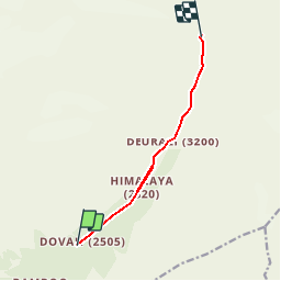
Dovan-Machapuchare BC

Elevation profile

Points of interest

Point of interest Ghandruk - Machapuchare BC - Photo
MickToul
GHANDRUK 
Point of interest Ghandruk - Deurali - Photo
MickToul
GHANDRUK 
Point of interest Ghandruk - Hiunchuli - Photo
MickToul
GHANDRUK 
Point of interest Narchyang - Annapurna Sud - Photo
MickToul
NARCHYANG 
Point of interest Ghandruk - Machapuchare - Photo
MickToul
GHANDRUK 
Point of interest Ghandruk - Mardi Himal - Photo
MickToul
GHANDRUK 
Point of interest Ghandruk -  - Photo
MickToul
GHANDRUK 

Positioning

Country:
Nepal
Region :
Unknown
Department/Province :
Kaski
Municipality :
Ghandruk
Location:
Unknown
Start:(UTM)
780876 ; 3152489 (44R) N.

Trails nearby

Trail Walking Ghandruk - ABC 09 - Photo
Walking
MickToul

Walking

Easy
Ghandruk, Unknown, Kaski, Nepal
6.3 km | 10.6 km-effort
1h 40min
No
Trail Walking Ghandruk - ABC 10 - Photo
Walking
MickToul

Walking

Medium
Ghandruk, Unknown, Kaski, Nepal
6.3 km | 13.1 km-effort
2h 28min
No


Close
My subscriptions