


Danvix -(9,5km)

olaze
User
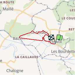

Length
9.5 km

Max alt
8 m

Uphill gradient
35 m
Km-Effort
9.9 km

Min alt
0 m

Downhill gradient
35 m
Boucle
Yes
Creation date :
2014-12-10 00:00:00.0
Updated on :
2019-02-06 07:55:30.03
2h28
Difficulty : Easy

FREE GPS app for hiking
 SityTrail
IGN / Geographical institutes
SityTrail Plus
The world is yours!
About
Trail Walking of 9.5 km to be discovered at Pays de la Loire, Vendée, Damvix. This trail is proposed by olaze.
Description
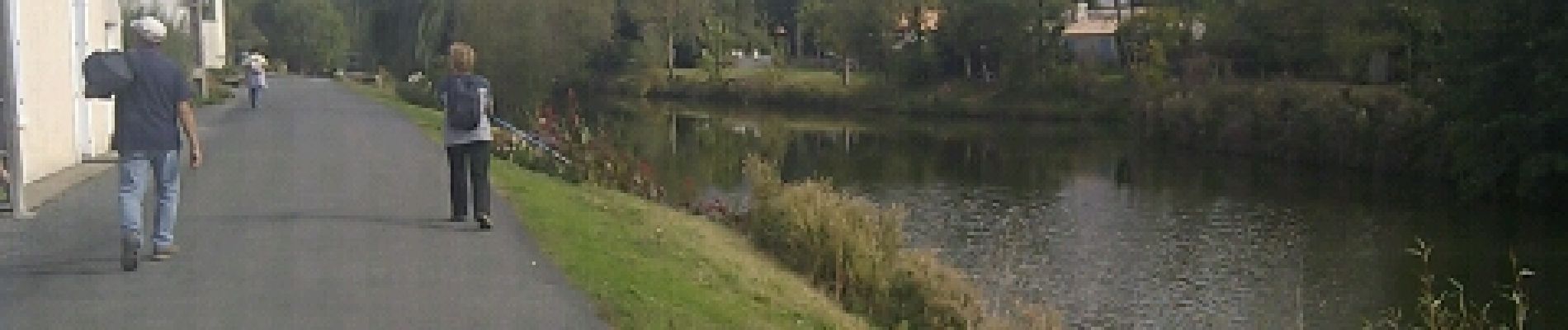
Agréable promenade le long de La Sèvre Niortaise,chemin de Bazouin, Bazoin, canal du nouveau Bejou.Départ & retour parking du port.
Club rando Bessines 2012
Photos
 - Photo 1")
 - Photo 2")
 - Photo 3")
 - Photo 4")
 - Photo 5")
 - Photo 6")
 - Photo 7")
Positioning
Country:
France
Region :
Pays de la Loire
Department/Province :
Vendée
Municipality :
Damvix
Location:
Unknown
Start:(Dec)
Start:(UTM)
674519 ; 5131411 (30T) N.
Comments