


ghj

mil351
User

Length
5.4 km

Max alt
312 m

Uphill gradient
57 m
Km-Effort
6.2 km

Min alt
263 m

Downhill gradient
70 m
Boucle
No
Creation date :
2014-12-10 00:00:00.0
Updated on :
2014-12-10 00:00:00.0
29m
Difficulty : Unknown

FREE GPS app for hiking
 SityTrail
IGN / Geographical institutes
SityTrail Plus
The world is yours!
About
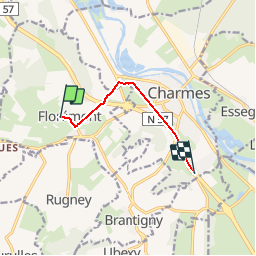
Trail Other activity of 5.4 km to be discovered at Grand Est, Vosges, Florémont. This trail is proposed by mil351.
Positioning
Country:
France
Region :
Grand Est
Department/Province :
Vosges
Municipality :
Florémont
Location:
Unknown
Start:(Dec)
Start:(UTM)
296529 ; 5360692 (32U) N.
Comments