


2012-10-12_Bruniquel

jcm17
User
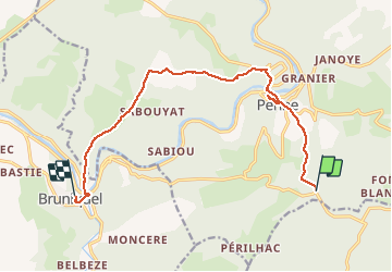

Length
14.5 km

Max alt
440 m

Uphill gradient
337 m
Km-Effort
19.8 km

Min alt
102 m

Downhill gradient
592 m
Boucle
No
Creation date :
2014-12-10 00:00:00.0
Updated on :
2014-12-10 00:00:00.0
4h03
Difficulty : Easy

FREE GPS app for hiking
 SityTrail
IGN / Geographical institutes
SityTrail Plus
The world is yours!
About
Trail Walking of 14.5 km to be discovered at Occitania, Tarn, Penne. This trail is proposed by jcm17.
Description
Rando ARDER Bastides Albigeoises
le 12/10/2012 Pas de la Lignée à Bruniquel via Penne (visite)
Positioning
Country:
France
Region :
Occitania
Department/Province :
Tarn
Municipality :
Penne
Location:
Unknown
Start:(Dec)
Start:(UTM)
399254 ; 4878967 (31T) N.
Comments