


ChevenozBise

svp59
User
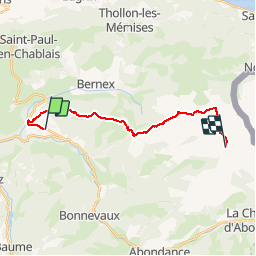

Length
16.2 km

Max alt
1962 m

Uphill gradient
1480 m
Km-Effort
34 km

Min alt
810 m

Downhill gradient
779 m
Boucle
No
Creation date :
2014-12-10 00:00:00.0
Updated on :
2014-12-10 00:00:00.0
7h13
Difficulty : Medium

FREE GPS app for hiking
 SityTrail
IGN / Geographical institutes
SityTrail Plus
The world is yours!
About
Trail Walking of 16.2 km to be discovered at Auvergne-Rhône-Alpes, Upper Savoy, Chevenoz. This trail is proposed by svp59.
Positioning
Country:
France
Region :
Auvergne-Rhône-Alpes
Department/Province :
Upper Savoy
Municipality :
Chevenoz
Location:
Unknown
Start:(Dec)
Start:(UTM)
318489 ; 5134393 (32T) N.
Comments