Trail Walking Haut-du-Them-Château-Lambert - Chateau-Lambert mines de cuivre et source de l'Oignon - Photo

Chateau-Lambert mines de cuivre et source de l'Oignon

 ballet
ballet

User

© OpenStreetMap contributors
Length
Length
9.6 km
Max alt
Max alt
940 m
Uphill gradient
Uphill gradient
369 m
Km-Effort
Km-Effort  
14.6 km
Min alt
Min alt
649 m
Downhill gradient
Downhill gradient
379 m
Boucle
Boucle
Yes
Creation date :
2014-12-10 00:00:00.0
Updated on :
2014-12-10 00:00:00.0

(1 Reviews)

Walking
Walking
2h30
Difficulty : Easy

Scan this QR Code to open this trail in the SityTrail application

FREE GPS app for hiking

Logo SityTrail SityTrail

IGN / Geographical institutes

Download SityTrail from the App Store Download SityTrail from Google Play

Logo SityTrail SityTrail World

The world is yours!

Download SityTrail from the App Store Download SityTrail from Google Play Download SityTrail on Huawei AppGallery

About

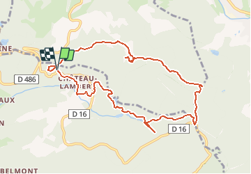
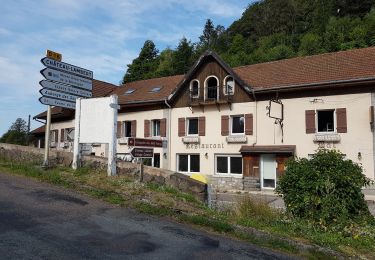
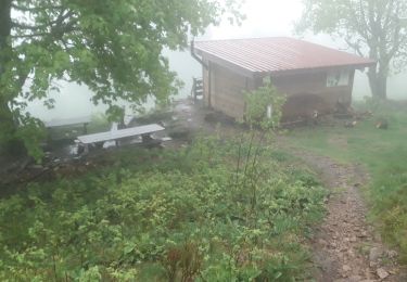
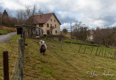
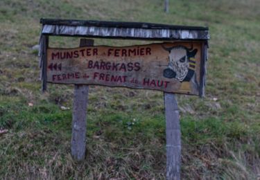
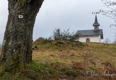
Trail Walking of 9.6 km to be discovered at Bourgogne-Franche-Comté, Haute-Saône, Haut-du-Them-Château-Lambert. This trail is proposed by ballet.

Description

Ce circuit vous fera découvrir les anciennes mines de cuivre du Thillot puis la source de l'Oignon et enfin le musée de Château-Lambert. Il emrunte des chemins en bon état donc est accessible à toute la famille. Prévoir une carte au 1/25ème car pas de balissage.

Elevation profile

Positioning

Country:
France
Region :
Bourgogne-Franche-Comté
Department/Province :
Haute-Saône
Municipality :
Haut-du-Them-Château-Lambert
Location:
Unknown
Start:(UTM)
331832 ; 5303012 (32T) N.

Comments

Please log in to post a review or rate the element


Trails nearby

Trail Walking Le Ménil - Boucle au départ des chalets de la
Walking
dboon

Walking

Easy
(3)
Le Ménil, Grand Est, Vosges, France
10 km | 14.1 km-effort
3h 0min
Yes
Trail On foot Fresse-sur-Moselle - Les ballons à l’horizon - Photo
On foot
PRO

On foot

Easy
Fresse-sur-Moselle, Grand Est, Vosges, France
7.7 km | 12.6 km-effort
2h 51min
Yes
Trail Walking Servance-Miellin - 2019-08-06 Marche Ballon Servance Ballon Alsace - Photo
Walking
GUIDE
holtzv

Walking

Very difficult
Servance-Miellin, Bourgogne-Franche-Comté, Haute-Saône, France
19.9 km | 31 km-effort
6h 23min
Yes
Trail Walking Fresse-sur-Moselle - Croix de Fresse - Vosges - France - Photo
Walking
boulou300

Walking

Medium
(1)
Fresse-sur-Moselle, Grand Est, Vosges, France
13.4 km | 19.6 km-effort
3h 10min
Yes
Trail Walking Le Thillot - Col des Croix - Vierge des Neiges - Hautes Mines - Tête des Noirs Étangs - Château Lambert - Photo
Walking
Bart2015

Walking

Easy
Le Thillot, Grand Est, Vosges, France
10.5 km | 16 km-effort
2h 23min
Yes
Trail Walking Saint-Maurice-sur-Moselle - Le Ballon de servance - Photo
Walking
margotte

Walking

Medium
Saint-Maurice-sur-Moselle, Grand Est, Vosges, France
14.1 km | 22 km-effort
3h 40min
Yes
Trail Walking Le Ménil - Grande boucle au départ des chalets de la Feigne sur de l'Eau - Photo
Walking
dboon

Walking

Difficult
Le Ménil, Grand Est, Vosges, France
21 km | 31 km-effort
5h 31min
Yes
Trail Walking Le Ménil - Le Ménil - Balade des deux chapelles - Photo
Walking
dboon

Walking

Difficult
Le Ménil, Grand Est, Vosges, France
13.8 km | 21 km-effort
3h 23min
Yes
Trail Walking Le Ménil - Boucle de La Chapelle de la Pitié  - Photo
Walking
dboon

Walking

Le Ménil, Grand Est, Vosges, France
8.3 km | 11.6 km-effort
2h 32min
Yes


Close
My subscriptions