


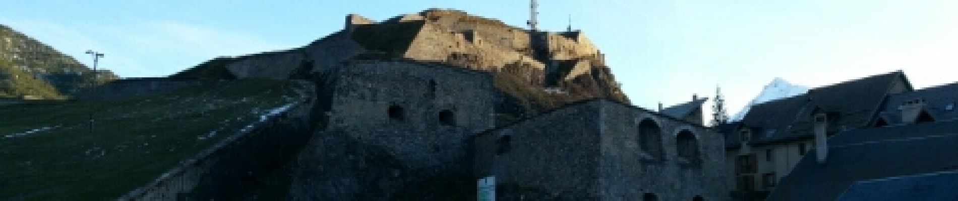
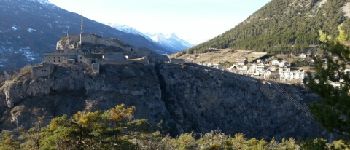
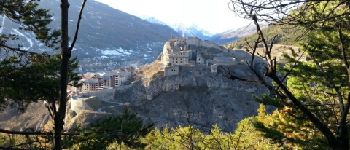
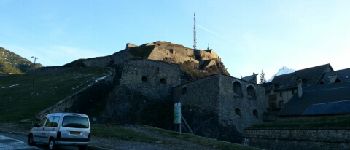
Briancon: Fort des Trois tètes

lhomme.ph
User GUIDE
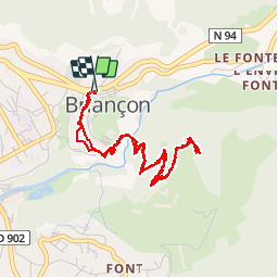

Length
5 km

Max alt
1426 m

Uphill gradient
263 m
Km-Effort
8.5 km

Min alt
1258 m

Downhill gradient
262 m
Boucle
Yes
Creation date :
2014-12-10 00:00:00.0
Updated on :
2014-12-10 00:00:00.0
2h08
Difficulty : Very easy

FREE GPS app for hiking
 SityTrail
IGN / Geographical institutes
SityTrail Plus
The world is yours!
About
Trail Walking of 5 km to be discovered at Provence-Alpes-Côte d'Azur, Hautes-Alpes, Briançon. This trail is proposed by lhomme.ph.
Description
Ballade découverte très facile. Une des plus belles vues sur la vielle ville de Briançon.
Photos


Positioning
Country:
France
Region :
Provence-Alpes-Côte d'Azur
Department/Province :
Hautes-Alpes
Municipality :
Briançon
Location:
Unknown
Start:(Dec)
Start:(UTM)
314016 ; 4974691 (32T) N.
Comments