Trail Walking Eygalières - Eygalières, Petit Calan - Photo
© OpenStreetMap contributors
Length
Length
8.2 km
Max alt
Max alt
242 m
Uphill gradient
Uphill gradient
167 m
Km-Effort
Km-Effort  
10.4 km
Min alt
Min alt
98 m
Downhill gradient
Downhill gradient
166 m
Boucle
Boucle
Yes
Creation date :
2014-12-10 00:00:00.0
Updated on :
2014-12-10 00:00:00.0

(1 Reviews)

Walking
Walking
2h15
Difficulty : Easy

Scan this QR Code to open this trail in the SityTrail application

FREE GPS app for hiking

Logo SityTrail SityTrail

IGN / Geographical institutes

Download SityTrail from the App Store Download SityTrail from Google Play

Logo SityTrail SityTrail World

The world is yours!

Download SityTrail from the App Store Download SityTrail from Google Play Download SityTrail on Huawei AppGallery

About

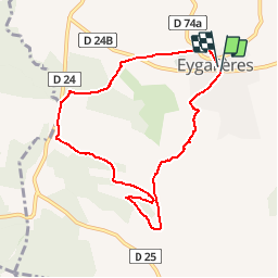
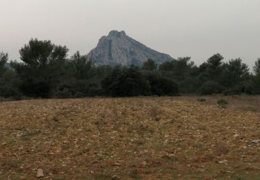
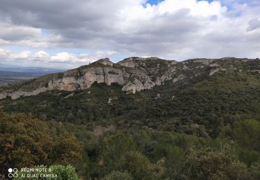
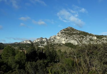
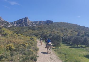
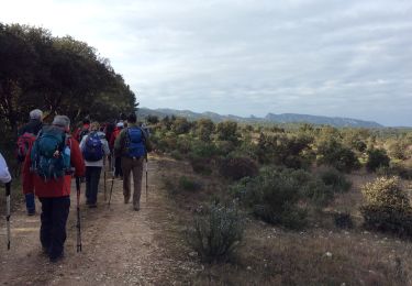
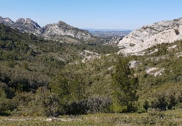
Trail Walking of 8.2 km to be discovered at Provence-Alpes-Côte d'Azur, Bouches-du-Rhône, Eygalières. This trail is proposed by Amaralain.

Description

Départ Mairie d'Eygalières - Les Molassis - Val Aurouso - Fort d'Ancise - Les Cordeliers et retour mairie.

Elevation profile

Points of interest

Point of interest Eygalières - CAIRN - Photo
Amaralain
EYGALIÈRES 

Positioning

Country:
France
Region :
Provence-Alpes-Côte d'Azur
Department/Province :
Bouches-du-Rhône
Municipality :
Eygalières
Location:
Unknown
Start:(Dec)
Start:(UTM)
656986 ; 4847132 (31T) N.

Comments

Please log in to post a review or rate the element


Aussi un très beau jogging d'environ 45 min une une courte montée tonique


Trails nearby

Trail Walking Orgon - plan Orgon di19mai2013 - Photo
Walking
tvtv84

Walking

Easy
(2)
Orgon, Provence-Alpes-Côte d'Azur, Bouches-du-Rhône, France
16 km | 18.8 km-effort
4h 28min
Yes
Trail Walking Eygalières - Eygalieres Tour de la Baume Brignolle - Photo
Walking
Manoune

Walking

Easy
Eygalières, Provence-Alpes-Côte d'Azur, Bouches-du-Rhône, France
13.6 km | 17.7 km-effort
4h 3min
Yes
Trail Walking Eygalières - Les Alpilles au dessus d'Eygalieres - Photo
Walking
MarcLEBARON

Walking

Medium
Eygalières, Provence-Alpes-Côte d'Azur, Bouches-du-Rhône, France
21 km | 28 km-effort
5h 28min
Yes
Trail Walking Saint-Rémy-de-Provence - Alpilles - Photo
Walking
darranger

Walking

Difficult
Saint-Rémy-de-Provence, Provence-Alpes-Côte d'Azur, Bouches-du-Rhône, France
13 km | 18.8 km-effort
3h 56min
Yes
Trail Walking Eygalières - Eygalières et les Calans  - Photo
Walking
GUIDE
nadinebondoux

Walking

Medium
Eygalières, Provence-Alpes-Côte d'Azur, Bouches-du-Rhône, France
19.7 km | 26 km-effort
5h 3min
Yes
Trail Horseback riding Eygalières - SityTrail - 2019-04-29 Rando CVA Alpilles Eygalieres Mouries - Photo
Horseback riding
GUIDE
holtzv

Horseback riding

Medium
Eygalières, Provence-Alpes-Côte d'Azur, Bouches-du-Rhône, France
24 km | 30 km-effort
3h 51min
No
Trail Walking Orgon - PF-Orgon - La Plaine des Alpilles - Photo
Walking
MicDul

Walking

Medium
(1)
Orgon, Provence-Alpes-Côte d'Azur, Bouches-du-Rhône, France
16.3 km | 21 km-effort
5h 13min
Yes
Trail Equestrian Orgon - Les Alpilles de provence  - Photo
Equestrian
Berbezier

Equestrian

Medium
(1)
Orgon, Provence-Alpes-Côte d'Azur, Bouches-du-Rhône, France
18.8 km | 22 km-effort
2h 51min
Yes
Trail Walking Eygalières - Le Gros Calan - Photo
Walking
SabetMick

Walking

Medium
Eygalières, Provence-Alpes-Côte d'Azur, Bouches-du-Rhône, France
10.7 km | 14.2 km-effort
3h 48min
Yes


Close
My subscriptions