Trail Other activity Jalhay - gr  573 - Photo
© OpenStreetMap contributors
Length
Length
16.4 km
Max alt
Max alt
467 m
Uphill gradient
Uphill gradient
379 m
Km-Effort
Km-Effort  
21 km
Min alt
Min alt
284 m
Downhill gradient
Downhill gradient
377 m
Boucle
Boucle
Yes
Creation date :
2014-12-10 00:00:00.0
Updated on :
2014-12-10 00:00:00.0

(0 Reviews)

Other activity
Other activity
4h30
Difficulty : Unknown

Scan this QR Code to open this trail in the SityTrail application

FREE GPS app for hiking

Logo SityTrail SityTrail

IGN / Geographical institutes

Download SityTrail from the App Store Download SityTrail from Google Play

Logo SityTrail SityTrail Plus

The world is yours!

Download SityTrail from the App Store Download SityTrail from Google Play Download SityTrail on Huawei AppGallery

About

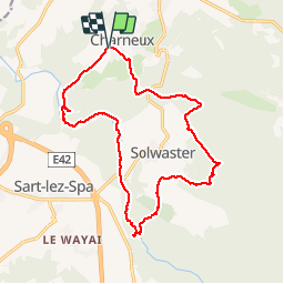
Trail Other activity of 16.4 km to be discovered at Wallonia, Liège, Jalhay. This trail is proposed by northman2.
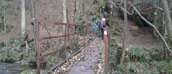
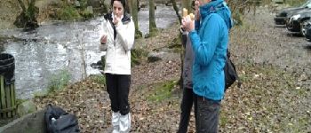
Elevation profile

Photos

Points of interest

Point of interest Jalhay - Pont sur la Hoegne  - Photo
northman2
Point of interest Jalhay - pique nique  - Photo
northman2
JALHAY 
Point of interest Jalhay - dolmen  - Photo
northman2
JALHAY 
Point of interest Jalhay - Rocher de Bilisse  - Photo
northman2

Positioning

Country:
Belgium
Region :
Wallonia
Department/Province :
Liège
Municipality :
Jalhay
Location:
Jalhay
Start:(UTM)
709040 ; 5603365 (31U) N.


Close
My subscriptions