Trail Walking Honnelles - Balade à Montignies-sur-Roc - Photo

Balade à Montignies-sur-Roc

 Desrumaux
Desrumaux

User GUIDE

© OpenStreetMap contributors
Length
Length
8 km
Max alt
Max alt
96 m
Uphill gradient
Uphill gradient
103 m
Km-Effort
Km-Effort  
9.4 km
Min alt
Min alt
48 m
Downhill gradient
Downhill gradient
108 m
Boucle
Boucle
Yes
Creation date :
2014-12-10 00:00:00.0
Updated on :
2014-12-10 00:00:00.0

(1 Reviews)

Walking
Walking
2h03
Difficulty : Very easy

Scan this QR Code to open this trail in the SityTrail application

FREE GPS app for hiking

Logo SityTrail SityTrail

IGN / Geographical institutes

Download SityTrail from the App Store Download SityTrail from Google Play

Logo SityTrail SityTrail World

The world is yours!

Download SityTrail from the App Store Download SityTrail from Google Play Download SityTrail on Huawei AppGallery

About

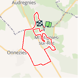
Trail Walking of 8 km to be discovered at Wallonia, Hainaut, Honnelles. This trail is proposed by Desrumaux.

Description

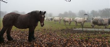
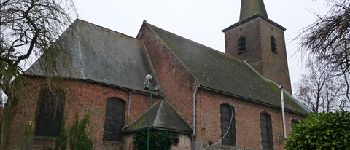
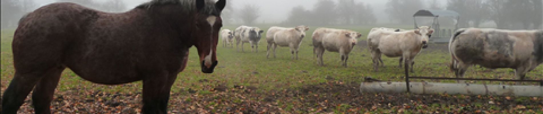
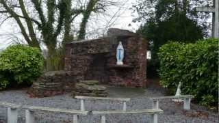
L’origine de Montignies-sur-Roc remonte à plus de dix siècles, le village au charme incontestable fait partie du Parc Naturel des Hauts-Pays et  doit son nom à sa situation sur un rocher, dominé par l’église.  Il s’étend sur les deux rives de la Petite Honnelle et est traversé, sur sa hauteur, par la chaussée romaine joignant Bavay à la Flandre. Le village s’articule autour de la belle place Fulgence Masson. C’est un espace arboré remarquable par sa configuration, ses tilleuls et les anciennes habitations qui la bordent. ®La Brasserie de l'Abbaye des Roc prend ses racines dans ce petit village verdoyant, véritable poumon vert d'une région jadis peuplée d'industries florissantes. Les activités brassicoles ont débuté en 1979.Départ : Eglise de Montignies-sur-Roc (Honnelles).

Elevation profile

Photos

Points of interest

Point of interest Honnelles - Montignies-sur-Roc - Photo
Desrumaux
Point of interest Honnelles - Montignies-sur-Roc - Photo
Desrumaux
Point of interest Honnelles - Montignies-sur-Roc - Photo
Desrumaux

Positioning

Country:
Belgium
Region :
Wallonia
Department/Province :
Hainaut
Municipality :
Honnelles
Location:
Montignies-sur-Roc
Start:(UTM)
552050 ; 5580161 (31U) N.

Comments

Please log in to post a review or rate the element


Trails nearby

Trail Walking Honnelles - Cani-Rando au Caillou qui Bique  - Photo
Walking
Pascal Catenne

Walking

Very easy
(1)
Honnelles, Wallonia, Hainaut, Belgium
3.3 km | 4 km-effort
1h 25min
Yes
Trail Nordic walking Dour - Mielikki marche nordique - Dour (Oxfam) - Photo
Nordic walking
mielikki

Nordic walking

Medium
(1)
Dour, Wallonia, Hainaut, Belgium
8.9 km | 10.1 km-effort
2h 0min
Yes
Trail Walking Honnelles - Promenade du caillou qui bique  - Photo
Walking
GUIDE+

Walking

Medium
(1)
Honnelles, Wallonia, Hainaut, Belgium
6.5 km | 8.1 km-effort
1h 50min
Yes
Trail On foot Honnelles - 2021-04-08 17_40_04 - Marche 12,552 km - Photo
On foot
Sihem Karkour

On foot

Easy
(1)
Honnelles, Wallonia, Hainaut, Belgium
13.3 km | 15.2 km-effort
3h 27min
Yes
Trail Walking Honnelles - montignies s_roc 0518 - Photo
Walking
calofrancis

Walking

Easy
(1)
Honnelles, Wallonia, Hainaut, Belgium
16.7 km | 19.6 km-effort
4h 16min
Yes
Trail Walking Honnelles - les jonquilles au caillou qui bique - Photo
Walking
papiou

Walking

Easy
(2)
Honnelles, Wallonia, Hainaut, Belgium
8.5 km | 10.3 km-effort
2h 6min
Yes
Trail Walking Dour - Le triangle des steriles1 - Photo
Walking
bc7380

Walking

Easy
(2)
Dour, Wallonia, Hainaut, Belgium
8 km | 9.3 km-effort
2h 2min
Yes
Trail Walking Honnelles - RB-Ha-14 - Raccourci - Autour de la forêt et de la basilique de Bonsecours - Photo
Walking
PRO

Walking

Very difficult
Honnelles, Wallonia, Hainaut, Belgium
22 km | 26 km-effort
5h 49min
Yes
Trail Walking Honnelles - RB-Ha-14 - Autour de la forêt et de la basilique de Bonsecours - Photo
Walking
PRO

Walking

Very difficult
(3)
Honnelles, Wallonia, Hainaut, Belgium
18.6 km | 21 km-effort
4h 52min
Yes


Close
My subscriptions