Trail Walking Maël-Pestivien - Maël-Pestivien - Chaire des druides - Photo

Maël-Pestivien - Chaire des druides

© OpenStreetMap contributors
Length
Length
13 km
Max alt
Max alt
296 m
Uphill gradient
Uphill gradient
206 m
Km-Effort
Km-Effort  
15.7 km
Min alt
Min alt
232 m
Downhill gradient
Downhill gradient
209 m
Boucle
Boucle
Yes
Creation date :
2014-12-10 00:00:00.0
Updated on :
2014-12-10 00:00:00.0

(0 Reviews)

Walking
Walking
3h24
Difficulty : Medium

Scan this QR Code to open this trail in the SityTrail application

FREE GPS app for hiking

Logo SityTrail SityTrail

IGN / Geographical institutes

Download SityTrail from the App Store Download SityTrail from Google Play

Logo SityTrail SityTrail World

The world is yours!

Download SityTrail from the App Store Download SityTrail from Google Play Download SityTrail on Huawei AppGallery

About

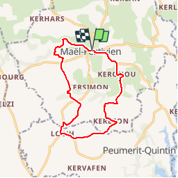
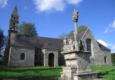
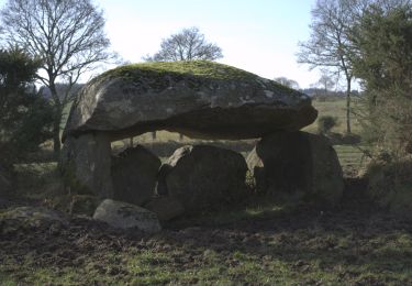
Trail Walking of 13 km to be discovered at Brittany, Côtes-d'Armor, Maël-Pestivien. This trail is proposed by FabienneD.

Description

Circuit de la chaire des druides
Description sur
http://www.callac-argoat.fr/Randonnees,82
Balisage jaune

Elevation profile

Points of interest

Point of interest Maël-Pestivien - Chaire des Druides - Photo
FabienneD
MAËL-PESTIVIEN 
Point of interest Maël-Pestivien - Dolmen - Photo
FabienneD
MAËL-PESTIVIEN 

Positioning

Country:
France
Region :
Brittany
Department/Province :
Côtes-d'Armor
Municipality :
Maël-Pestivien
Location:
Unknown
Start:(UTM)
478049 ; 5360156 (30U) N.

Trails nearby

Trail Walking Bulat-Pestivien - Le circuit des tailleurs de pierres - Bulat - Pestivien - Photo
Walking
tracegps

Walking

Easy
Bulat-Pestivien, Brittany, Côtes-d'Armor, France
3.5 km | 4.2 km-effort
1h 0min
Yes
Trail On foot Maël-Pestivien - De Gurunhuel à Port-Louis - Photo
On foot
PRO

On foot

Easy
Maël-Pestivien, Brittany, Côtes-d'Armor, France
3.2 km | 3.9 km-effort
53min
No


Close
My subscriptions