


O2bikers_154_Aubel

O2 bikers
Randonnées de O2bikers GUIDE+

Length
40 km

Max alt
344 m

Uphill gradient
566 m
Km-Effort
47 km

Min alt
190 m

Downhill gradient
566 m
Boucle
Yes
Creation date :
2014-12-11 00:00:00.0
Updated on :
2014-12-11 00:00:00.0
6h05
Difficulty : Unknown

FREE GPS app for hiking
 SityTrail
IGN / Geographical institutes
SityTrail Plus
The world is yours!
About
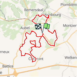
Trail Mountain bike of 40 km to be discovered at Wallonia, Liège, Plombières. This trail is proposed by O2 bikers.
Photos


Positioning
Country:
Belgium
Region :
Wallonia
Department/Province :
Liège
Municipality :
Plombières
Location:
Hombourg
Start:(Dec)
Start:(UTM)
704723 ; 5620070 (31U) N.
Comments