


O2bikers_133_Francorchamps

O2 bikers
Randonnées de O2bikers GUIDE+

Length
37 km

Max alt
566 m

Uphill gradient
796 m
Km-Effort
48 km

Min alt
311 m

Downhill gradient
798 m
Boucle
Yes
Creation date :
2014-12-11 00:00:00.0
Updated on :
2014-12-11 00:00:00.0
7h04
Difficulty : Unknown

FREE GPS app for hiking
 SityTrail
IGN / Geographical institutes
SityTrail Plus
The world is yours!
About
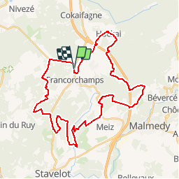
Trail Mountain bike of 37 km to be discovered at Wallonia, Liège, Stavelot. This trail is proposed by O2 bikers.
Positioning
Country:
Belgium
Region :
Wallonia
Department/Province :
Liège
Municipality :
Stavelot
Location:
Francorchamps
Start:(Dec)
Start:(UTM)
709588 ; 5593910 (31U) N.
Comments
assez technique mais très belle balade