


O2bikers_122_Namur Dinant

O2 bikers
Randonnées de O2bikers GUIDE+

Length
43 km

Max alt
287 m

Uphill gradient
1003 m
Km-Effort
57 km

Min alt
74 m

Downhill gradient
1095 m
Boucle
No
Creation date :
2014-12-11 00:00:00.0
Updated on :
2014-12-11 00:00:00.0
7h21
Difficulty : Unknown

FREE GPS app for hiking
 SityTrail
IGN / Geographical institutes
SityTrail Plus
The world is yours!
About
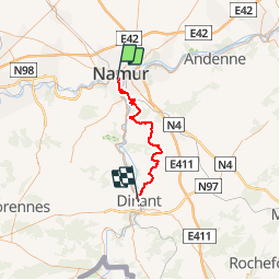
Trail Mountain bike of 43 km to be discovered at Wallonia, Namur, Namur. This trail is proposed by O2 bikers.
Positioning
Country:
Belgium
Region :
Wallonia
Department/Province :
Namur
Municipality :
Namur
Location:
Namur
Start:(Dec)
Start:(UTM)
631757 ; 5591041 (31U) N.
Comments
