Trail Walking Montcuq-en-Quercy-Blanc - De Montcuq à la Chapelle de St Génies - Photo

De Montcuq à la Chapelle de St Génies

 tracegps
tracegps

User

© OpenStreetMap contributors
Length
Length
13.5 km
Max alt
Max alt
274 m
Uphill gradient
Uphill gradient
255 m
Km-Effort
Km-Effort  
16.9 km
Min alt
Min alt
150 m
Downhill gradient
Downhill gradient
255 m
Boucle
Boucle
Yes
Creation date :
2014-12-10 00:00:00.0
Updated on :
2014-12-10 00:00:00.0

(1 Reviews)

Walking
Walking
2h45
Difficulty : Medium

Scan this QR Code to open this trail in the SityTrail application

FREE GPS app for hiking

Logo SityTrail SityTrail

IGN / Geographical institutes

Download SityTrail from the App Store Download SityTrail from Google Play

Logo SityTrail SityTrail World

The world is yours!

Download SityTrail from the App Store Download SityTrail from Google Play Download SityTrail on Huawei AppGallery

About

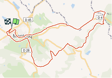
Trail Walking of 13.5 km to be discovered at Occitania, Lot, Montcuq-en-Quercy-Blanc. This trail is proposed by tracegps.

Description

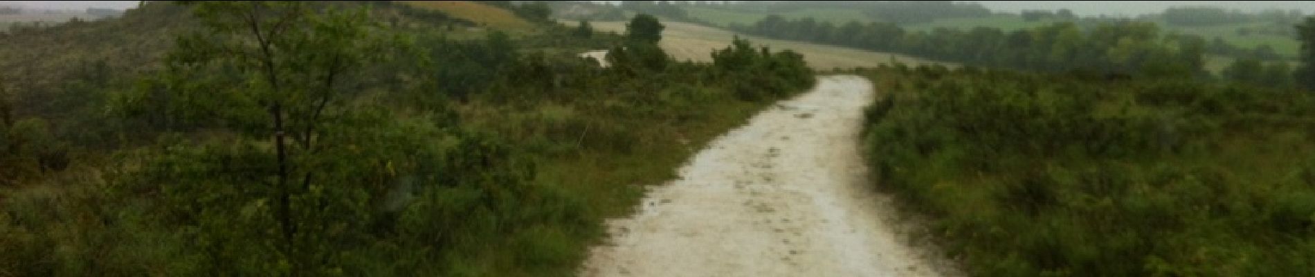
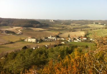
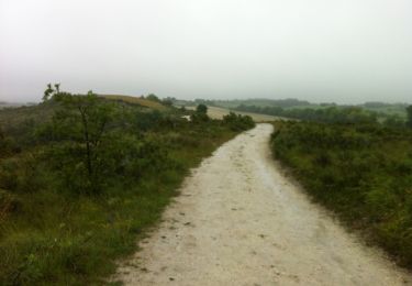
Départ de Montcuq, depuis le gymnase traverser le camping jusqu'au terrain de tennis, en direction du restaurant (La Barguelonne). Prendre la route derrière le restaurant. Sur le circuit vous trouverez : Pas de la Mule : Vous pourrez apercevoir dans le rocher, quatre traces de pas de mule. Source de Montcuq : Sur le chemin, vous trouverez le captage alimentant Montcuq en eau potable dans la première moitié du XX è siècle et la fontaine du Thouron. Chemin botanique : Il permet de découvrir la végétation caractéristique du Quercy Blanc. Chapelle de Bertrand St Génies. Source du Bousquet. Chemin de Compostelle.

Elevation profile

Photos

Positioning

Country:
France
Region :
Occitania
Department/Province :
Lot
Municipality :
Montcuq-en-Quercy-Blanc
Location:
Unknown
Start:(UTM)
356738 ; 4911335 (31T) N.

Comments

Please log in to post a review or rate the element


Bonne application mais perfectible pour iPhone


Trails nearby

Trail Walking Barguelonne-en-Quercy - Circuit sur les chemins blancs de Bagat - Balat en Quercy - Photo
Walking
tracegps

Walking

Medium
(1)
Barguelonne-en-Quercy, Occitania, Lot, France
10.9 km | 13 km-effort
3h 0min
Yes
Trail Mountain bike Barguelonne-en-Quercy - Circuit sur les chemins blancs de Bagat - Balat en Quercy - Photo
Mountain bike
tracegps

Mountain bike

Medium
Barguelonne-en-Quercy, Occitania, Lot, France
10.9 km | 13 km-effort
1h 0min
Yes
Trail Mountain bike Montcuq-en-Quercy-Blanc - De Montcuq à la Chapelle de St Génies - Photo
Mountain bike
tracegps

Mountain bike

Medium
Montcuq-en-Quercy-Blanc, Occitania, Lot, France
13.5 km | 16.9 km-effort
1h 0min
Yes
Trail Walking Barguelonne-en-Quercy - chemin blanc de Bagat - Photo
Walking
saligne

Walking

Easy
Barguelonne-en-Quercy, Occitania, Lot, France
11.5 km | 13.7 km-effort
2h 37min
Yes
Trail Horseback riding Lendou-en-Quercy - montcuq - Photo
Horseback riding
jces

Horseback riding

Medium
Lendou-en-Quercy, Occitania, Lot, France
18.8 km | 23 km-effort
2h 55min
Yes
Trail Horseback riding Lendou-en-Quercy - marcillac - Photo
Horseback riding
jces

Horseback riding

Medium
Lendou-en-Quercy, Occitania, Lot, France
25 km | 31 km-effort
3h 52min
Yes
Trail Mountain bike Montcuq-en-Quercy-Blanc - SityTrail - Compostelle 2 Etape 4 - Photo
Mountain bike
napoli

Mountain bike

Very difficult
Montcuq-en-Quercy-Blanc, Occitania, Lot, France
38 km | 48 km-effort
4h 30min
No
Trail Walking Barguelonne-en-Quercy - saint pantaleon - Photo
Walking
GUIDE
antignacs

Walking

Easy
Barguelonne-en-Quercy, Occitania, Lot, France
12.2 km | 14.5 km-effort
2h 28min
Yes
Trail Walking Montcuq-en-Quercy-Blanc - Compostelle 18 - Montcuq -> Durfort-Lacapelette - Photo
Walking
uru2010

Walking

Medium
Montcuq-en-Quercy-Blanc, Occitania, Lot, France
29 km | 39 km-effort
8h 7min
No


Close
My subscriptions