Trail Mountain bike Saint-Jean-la-Vêtre - VVF - Ventuel - Saint-Jean-La-Vêtre - Circuit 2 - Photo

VVF - Ventuel - Saint-Jean-La-Vêtre - Circuit 2

 tracegps
tracegps

User

© OpenStreetMap contributors
Length
Length
15.3 km
Max alt
Max alt
936 m
Uphill gradient
Uphill gradient
389 m
Km-Effort
Km-Effort  
20 km
Min alt
Min alt
598 m
Downhill gradient
Downhill gradient
385 m
Boucle
Boucle
Yes
Creation date :
2014-12-10 00:00:00.0
Updated on :
2014-12-10 00:00:00.0

(0 Reviews)

Mountain bike
Mountain bike
2h00
Difficulty : Medium

Scan this QR Code to open this trail in the SityTrail application

FREE GPS app for hiking

Logo SityTrail SityTrail

IGN / Geographical institutes

Download SityTrail from the App Store Download SityTrail from Google Play

Logo SityTrail SityTrail World

The world is yours!

Download SityTrail from the App Store Download SityTrail from Google Play Download SityTrail on Huawei AppGallery

About

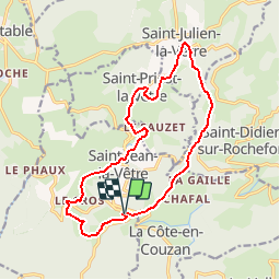
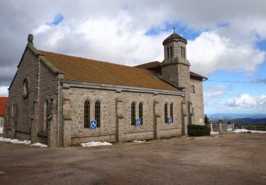
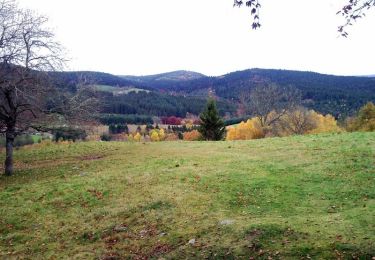
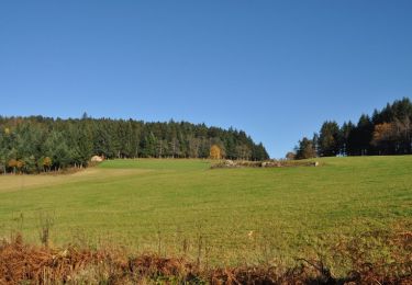
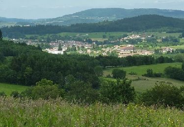
Trail Mountain bike of 15.3 km to be discovered at Auvergne-Rhône-Alpes, Loire, Saint-Jean-la-Vêtre. This trail is proposed by tracegps.

Description

Un circuit plus corsé que le N°4 et n°1(dispo sur TraceGPS). Attention, entre La Chapelle des Anges et Saint Julien La Vêtre descente dangereuse par endroits. Montée de Saint Jean La Vêtre à Ventuel difficile. Bonne rando

Elevation profile

Photos

Points of interest

Point of interest Saint-Jean-la-Vêtre - Village vacances VVF saint-Jean-La-Vêtre - Photo
tracegps
SAINT-JEAN-LA-VÊTRE 

Positioning

Country:
France
Region :
Auvergne-Rhône-Alpes
Department/Province :
Loire
Municipality :
Saint-Jean-la-Vêtre
Location:
Unknown
Start:(UTM)
562686 ; 5069561 (31T) N.

Trails nearby

Trail Mountain bike Saint-Didier-sur-Rochefort - La Brosse Jour 3 - Photo
Mountain bike
jm.lemore

Mountain bike

Medium
(1)
Saint-Didier-sur-Rochefort, Auvergne-Rhône-Alpes, Loire, France
26 km | 36 km-effort
2h 28min
Yes
Trail Equestrian La Chambonie - Chalmazel J1 PV Col de la loge -Ganier J0-J1 - Photo
Equestrian
azipat

Equestrian

Medium
(1)
La Chambonie, Auvergne-Rhône-Alpes, Loire, France
27 km | 38 km-effort
4h 33min
No
Trail Equestrian Chalmazel-Jeansagnière - Chalmazel J3  Boucle col de la loge J3 - Photo
Equestrian
azipat

Equestrian

Medium
(1)
Chalmazel-Jeansagnière, Auvergne-Rhône-Alpes, Loire, France
30 km | 43 km-effort
5h 9min
Yes
Trail Walking Chalmazel-Jeansagnière - col de la loge 9,5 km - Photo
Walking
famillerudent

Walking

Medium
Chalmazel-Jeansagnière, Auvergne-Rhône-Alpes, Loire, France
9.4 km | 11.8 km-effort
2h 41min
Yes
Trail Cycle Noirétable - Col du Frissonnet et du Pertuis - Noirétable - Photo
Cycle
tracegps

Cycle

Medium
Noirétable, Auvergne-Rhône-Alpes, Loire, France
42 km | 52 km-effort
2h 0min
Yes
Trail Mountain bike Noirétable - La Croix St Guillaume - Noirétable - Photo
Mountain bike
tracegps

Mountain bike

Difficult
Noirétable, Auvergne-Rhône-Alpes, Loire, France
19.2 km | 27 km-effort
1h 45min
Yes
Trail Mountain bike Noirétable - Chausseterre - Noirétable - Photo
Mountain bike
tracegps

Mountain bike

Medium
Noirétable, Auvergne-Rhône-Alpes, Loire, France
25 km | 34 km-effort
2h 0min
Yes
Trail Mountain bike Noirétable - Col du St Thomas - Noirétable - Photo
Mountain bike
tracegps

Mountain bike

Medium
Noirétable, Auvergne-Rhône-Alpes, Loire, France
23 km | 30 km-effort
2h 0min
Yes
Trail Mountain bike Noirétable - 12ème Bois Noirs Oxygène (2013-VTT-100km) - Noirétable - Photo
Mountain bike
tracegps

Mountain bike

Very difficult
Noirétable, Auvergne-Rhône-Alpes, Loire, France
100 km | 137 km-effort
8h 30min
Yes


Close
My subscriptions