


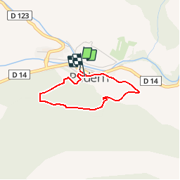


18.6 km | 26 km-effort

User


FREE GPS app for hiking
 SityTrail
IGN / Geographical institutes
SityTrail World
The world is yours!
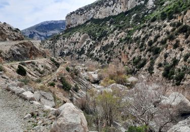
Trail Walking of 2.6 km to be discovered at Occitania, Aude, Padern. This trail is proposed by tracegps.
Dirigez-vous vers l’église pour monter vers le château de Padern en suivant le sentier cathare (balises jaunes/bleues) qui démarre dans la ruelle à droite de l’église. Passez devant la chapelle romane Saint-Roch et continuez vers le château. Cette chapelle rustique dotée d’une abside semi-circulaire, conserve encore une petite fenêtre romane, les autres datent du XIXè siècle. (1) Vous arrivez au château. Pour continuer la boucle, laissez le sentier cathare (en face) pour prendre à gauche un autre sentier qui grimpe dans une pinède. Après avoir franchi le petit col "Pas de Massac" en empruntant l’ancien chemin muletier, vous arrivez sur un chemin que vous prenez à gauche. Progressivement s’offrent à votre vue la plaine de Tuchan et dans le fond, les falaises de Vingrau haut lieu de la "grimpe". Vous arrivez au croisement du chemin avec un sentier qui court en lisière d’une ancienne vigne. Ne le prenez pas, c’est un autre itinéraire. Pour revenir à Padern prendre à gauche (balisage jaune/vert) le chemin qui à travers les vignes, vous amènera à un sentier. Laissez l’itinéraire de droite et (2) prendre à gauche. Vous arrivez dans le village par la rue Sainte Cécile (ancienne rue longue) qui rejoint la placette de l’église. A VOIR : Le Château est détruit en 1255 sur ordre de Saint Louis, il fut reconstruit au XVIIème siècle par la famille De Vic après les guerres de religion. La forteresse se compose d’un donjon, d’une puissante enceinte et d’une défense avancée qui protège sa face nord-est.

Walking
Walking

Walking
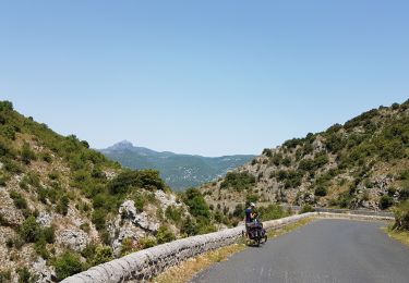
Bicycle tourism