Trail Walking Pradelles - Trois jours sur la Régordane de Pradelles à Génolhac - Photo

Trois jours sur la Régordane de Pradelles à Génolhac

 tracegps
tracegps

User

© OpenStreetMap contributors
Length
Length
74 km
Max alt
Max alt
1229 m
Uphill gradient
Uphill gradient
2023 m
Km-Effort
Km-Effort  
103 km
Min alt
Min alt
514 m
Downhill gradient
Downhill gradient
2642 m
Boucle
Boucle
No
Creation date :
2014-12-10 00:00:00.0
Updated on :
2014-12-10 00:00:00.0

(0 Reviews)

Walking
Walking
19h00
Difficulty : Difficult

Scan this QR Code to open this trail in the SityTrail application

FREE GPS app for hiking

Logo SityTrail SityTrail

IGN / Geographical institutes

Download SityTrail from the App Store Download SityTrail from Google Play

Logo SityTrail SityTrail World

The world is yours!

Download SityTrail from the App Store Download SityTrail from Google Play Download SityTrail on Huawei AppGallery

About

Trail Walking of 74 km to be discovered at Auvergne-Rhône-Alpes, Haute-Loire, Pradelles. This trail is proposed by tracegps.

Description

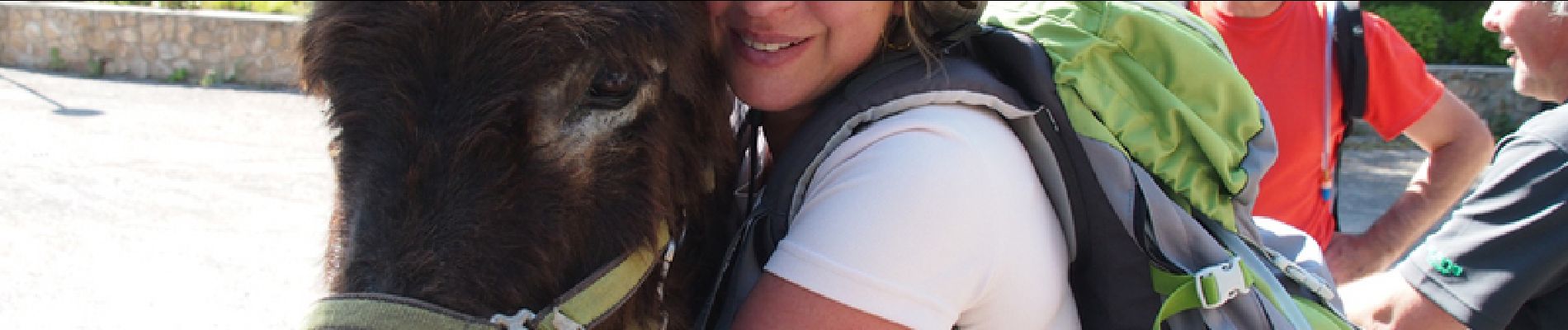
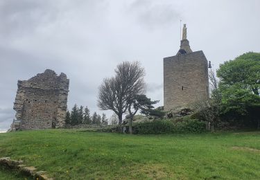
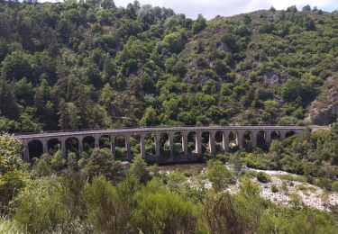
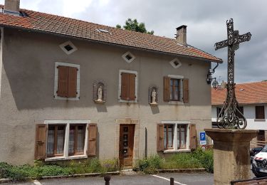
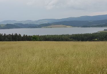
Sur le chemin de Régordane (GR700) balisage rectangles rouge et blanc à travers Haute-Loire, Ardèche, Lozère et Gard : 73,6 km en trois jours. La veille, arrivée en car à Pradelles. Le premier jour, 29,2km ...sans les ânes, de Pradelles à l’abbaye Notre-Dame des Neiges (monastère cistercien). Après le dîner, on y fait la vaisselle en commun (sympa). Le matin du deuxième jour, après la messe avec les moines (facultative) et le petit-déjeuner, départ avec les « ânes de Gilles » qui nous attendaient dans un pré devant l’abbaye. Direction Villefort à 27,1km, avec une belle étape à la Garde Guérin, village médiéval. Les ânes passent la nuit dans un gîte équestre et nous dans un gîte d’étape à proximité. Le lendemain direction Génolhac à 17,3km. A l’arrivée, Gilles récupère ses ânes, tandis que nous les voyons partir à regret. Soirée à Génolhac et départ le lendemain, en train, depuis la gare sur la ligne du Cévenol.

Elevation profile

Photos

Positioning

Country:
France
Region :
Auvergne-Rhône-Alpes
Department/Province :
Haute-Loire
Municipality :
Pradelles
Location:
Unknown
Start:(Dec)
Start:(UTM)
569779 ; 4957725 (31T) N.

Trails nearby

Trail Mountain bike Langogne - Espace VTT FFC du Gévaudan - n°08 - Circuit  du Ras Chambon - Photo
Mountain bike
tracegps

Mountain bike

Difficult
(2)
Langogne, Occitania, Lozère, France
17.2 km | 22 km-effort
2h 15min
Yes
Trail Walking Langogne - E4 Langogne - Luc GR70 - Photo
Walking
GUIDE
Kargil

Walking

Difficult
Langogne, Occitania, Lozère, France
28 km | 38 km-effort
7h 6min
No
Trail Walking Pradelles - Etape 3 Pradelles  Haut cheylard l évêque  - Photo
Walking
Nathalie. Mercier

Walking

Difficult
Pradelles, Auvergne-Rhône-Alpes, Haute-Loire, France
23 km | 30 km-effort
5h 46min
No
Trail Walking Langogne - 09-05-2023 E4 Langogne - Luc - Photo
Walking
GUIDE
Kargil

Walking

Difficult
Langogne, Occitania, Lozère, France
28 km | 38 km-effort
8h 35min
No
Trail Road bike Langogne - Langogne, le nouveau monde - Photo
Road bike
nadd73

Road bike

Medium
Langogne, Occitania, Lozère, France
68 km | 85 km-effort
4h 31min
Yes
Trail Road bike Langogne - NAUSSAC - COL DE LA PIERRE PLANTEE - Photo
Road bike
jean-marie.parachini

Road bike

Easy
Langogne, Occitania, Lozère, France
76 km | 91 km-effort
6h 20min
Yes
Trail Road bike Langogne - NAUSSAC - FORÊT DE MERCOIRE - Photo
Road bike
jean-marie.parachini

Road bike

Medium
Langogne, Occitania, Lozère, France
68 km | 81 km-effort
5h 40min
Yes
Trail Road bike Langogne - NAUSSAC - CHAPEAUROUX - Photo
Road bike
jean-marie.parachini

Road bike

Medium
Langogne, Occitania, Lozère, France
74 km | 94 km-effort
6h 29min
No
Trail Road bike Langogne - NAUSSAC - COL CROIX DE BOR ET COL DES 3 SOEURS - Photo
Road bike
jean-marie.parachini

Road bike

Medium
Langogne, Occitania, Lozère, France
67 km | 83 km-effort
5h 19min
Yes


Close
My subscriptions