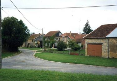
Trail Walking Saint-Pierremont - De St Pierremont à Vaux en Dieulet - Photo

De St Pierremont à Vaux en Dieulet

 tracegps
tracegps

User

© OpenStreetMap contributors
Length
Length
16.3 km
Max alt
Max alt
300 m
Uphill gradient
Uphill gradient
271 m
Km-Effort
Km-Effort  
19.9 km
Min alt
Min alt
188 m
Downhill gradient
Downhill gradient
272 m
Boucle
Boucle
Yes
Creation date :
2014-12-10 00:00:00.0
Updated on :
2014-12-10 00:00:00.0

(0 Reviews)

Walking
Walking
3h34
Difficulty : Difficult

Scan this QR Code to open this trail in the SityTrail application

FREE GPS app for hiking

Logo SityTrail SityTrail

IGN / Geographical institutes

Download SityTrail from the App Store Download SityTrail from Google Play

Logo SityTrail SityTrail World

The world is yours!

Download SityTrail from the App Store Download SityTrail from Google Play Download SityTrail on Huawei AppGallery

About

Trail Walking of 16.3 km to be discovered at Grand Est, Ardennes, Saint-Pierremont. This trail is proposed by tracegps.

Description

Départ: église de St Pierremont, suivre le GR14 (blanc et rouge) jusqu’à Fontenois. Continuer la route puis chemin à gauche. Après le 5ème km, aire de repos avec tables. Jolie descente sur Vaux en Dieulet. Remontez sur Sommauthe (bar restaurant) puis retour sur St Pierremont. Vous passez devant le château. Circuit possible en période de chasse. Pas de forêt.

Elevation profile

Photos

Positioning

Country:
France
Region :
Grand Est
Department/Province :
Ardennes
Municipality :
Saint-Pierremont
Location:
Unknown
Start:(UTM)
640305 ; 5483317 (31U) N.

Trails nearby

Trail Mountain bike Autruche - Autour d'Autruche  - Photo
Mountain bike
tracegps

Mountain bike

Easy
Autruche, Grand Est, Ardennes, France
10 km | 11.9 km-effort
30min
Yes
Trail Walking Autruche - Autour d'Autruche  - Photo
Walking
tracegps

Walking

Medium
Autruche, Grand Est, Ardennes, France
10 km | 11.9 km-effort
2h 30min
Yes


Close
My subscriptions