Trail Walking Pommerieux - Circuit de la Rouette - Pommerieux - Photo

Circuit de la Rouette - Pommerieux

 tracegps
tracegps

User

© OpenStreetMap contributors
Length
Length
12.3 km
Max alt
Max alt
77 m
Uphill gradient
Uphill gradient
95 m
Km-Effort
Km-Effort  
13.6 km
Min alt
Min alt
46 m
Downhill gradient
Downhill gradient
97 m
Boucle
Boucle
Yes
Creation date :
2014-12-10 00:00:00.0
Updated on :
2014-12-10 00:00:00.0

(0 Reviews)

Walking
Walking
3h04
Difficulty : Medium

Scan this QR Code to open this trail in the SityTrail application

FREE GPS app for hiking

Logo SityTrail SityTrail

IGN / Geographical institutes

Download SityTrail from the App Store Download SityTrail from Google Play

Logo SityTrail SityTrail World

The world is yours!

Download SityTrail from the App Store Download SityTrail from Google Play Download SityTrail on Huawei AppGallery

About

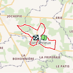
Trail Walking of 12.3 km to be discovered at Pays de la Loire, Mayenne, Pommerieux. This trail is proposed by tracegps.

Description

Départ de la place de l'église de Pommerieux. En patois mayennais, la rouette est un brin d'osier. Dans cette campagne, la rouette évoque sans doute la vannerie traditionnelle.

Elevation profile

Photos

Positioning

Country:
France
Region :
Pays de la Loire
Department/Province :
Mayenne
Municipality :
Pommerieux
Location:
Unknown
Start:(UTM)
657334 ; 5298815 (30T) N.

Trails nearby

Trail Walking Craon - Craon - Photo
Walking
neoroll44

Walking

Medium
Craon, Pays de la Loire, Mayenne, France
14.2 km | 15.7 km-effort
3h 40min
Yes
Trail Walking Craon - Craon 11-10-2021 - Photo
Walking
piquet

Walking

Medium
Craon, Pays de la Loire, Mayenne, France
9.1 km | 10 km-effort
6h 46min
Yes
Trail On foot Pommerieux - POMMERIEUX - Photo
On foot
JMJ53350

On foot

Easy
Pommerieux, Pays de la Loire, Mayenne, France
7.2 km | 7.8 km-effort
1h 46min
Yes


Close
My subscriptions