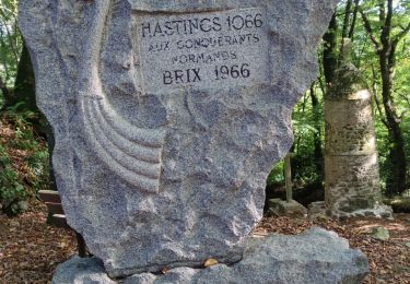
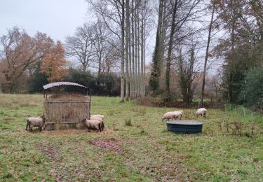
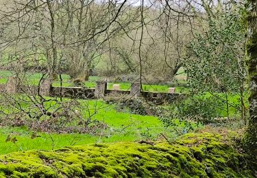
Trail Mountain bike Saint-Martin-le-Gréard - La Royale - Saint Martin le Gréard - Photo

La Royale - Saint Martin le Gréard

 tracegps
tracegps

User

© OpenStreetMap contributors
Length
Length
21 km
Max alt
Max alt
157 m
Uphill gradient
Uphill gradient
338 m
Km-Effort
Km-Effort  
26 km
Min alt
Min alt
62 m
Downhill gradient
Downhill gradient
338 m
Boucle
Boucle
Yes
Creation date :
2014-12-10 00:00:00.0
Updated on :
2014-12-10 00:00:00.0

(0 Reviews)

Mountain bike
Mountain bike
2h00
Difficulty : Medium

Scan this QR Code to open this trail in the SityTrail application

FREE GPS app for hiking

Logo SityTrail SityTrail

IGN / Geographical institutes

Download SityTrail from the App Store Download SityTrail from Google Play

Logo SityTrail SityTrail World

The world is yours!

Download SityTrail from the App Store Download SityTrail from Google Play Download SityTrail on Huawei AppGallery

About

Trail Mountain bike of 21 km to be discovered at Normandy, Manche, Saint-Martin-le-Gréard. This trail is proposed by tracegps.

Description

Circuit concocté par Zaza, du club des HAGUARDS. Composé de chemins carrossés, de singles, de passages entre les arbres de petits sentiers entre les haies et de chemins caillouteux, ce circuit est très varié, idéal pour découvrir le secteur autrement que par la route. N'hésitez pas à venir rouler avec nous car le club LES HAGUARDS vous donne rendez-vous tous les dimanches si, comme nous, vous appréciez les randos dans une ambiance conviviale et sportive (si besoin nous formons plusieurs groupes de niveaux différents). LES HAGUARDS ne sont pas sectaires et apprécient aussi de pratiquer d'autres activités sportives telles que les raids multisports, trails, triathlons etc........

Elevation profile

Photos

Positioning

Country:
France
Region :
Normandy
Department/Province :
Manche
Municipality :
Saint-Martin-le-Gréard
Location:
Unknown
Start:(UTM)
597775 ; 5490265 (30U) N.

Trails nearby

Trail Walking Brix - Brix - Photo
Walking
PatRando

Walking

Medium
Brix, Normandy, Manche, France
11.4 km | 14.3 km-effort
2h 30min
Yes
Trail Mountain bike Tollevast - La Tollevastaise 2013 - Photo
Mountain bike
tracegps

Mountain bike

Medium
Tollevast, Normandy, Manche, France
53 km | 66 km-effort
3h 0min
Yes
Trail Walking Tollevast - Tollevast - Photo
Walking
PatRando

Walking

Medium
Tollevast, Normandy, Manche, France
9.1 km | 11.1 km-effort
1h 58min
Yes
Trail Mountain bike Tollevast - Tollevastaise 2012 - 50 km - Photo
Mountain bike
tracegps

Mountain bike

Medium
Tollevast, Normandy, Manche, France
49 km | 60 km-effort
2h 30min
No
Trail Mountain bike Tollevast - Tollevastaise 2011 - 50 km - Photo
Mountain bike
tracegps

Mountain bike

Difficult
Tollevast, Normandy, Manche, France
52 km | 62 km-effort
3h 0min
Yes
Trail Walking Sideville - Sideville 18 mars 2024 - Photo
Walking
PatRando

Walking

Easy
Sideville, Normandy, Manche, France
7.7 km | 9.9 km-effort
1h 52min
Yes
Trail Walking Brix - Brix 12 km 2020-02-27 - Photo
Walking
clrunavot

Walking

Difficult
Brix, Normandy, Manche, France
13.1 km | 15.9 km-effort
3h 36min
Yes
Trail Walking Sottevast - Sottevast - 11 km - Photo
Walking
AMOURETTE

Walking

Difficult
Sottevast, Normandy, Manche, France
11.1 km | 13.4 km-effort
2h 54min
Yes
Trail Walking Couville - Couville 12-04-2014 - Photo
Walking
AMOURETTE

Walking

Easy
Couville, Normandy, Manche, France
19.2 km | 22 km-effort
4h 50min
Yes


Close
My subscriptions