


Rochegude-roquette

mapomme
User
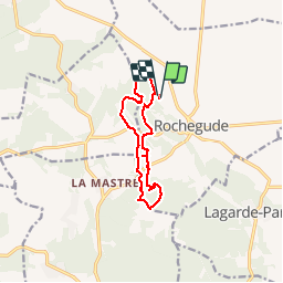

Length
11.2 km

Max alt
278 m

Uphill gradient
260 m
Km-Effort
14.6 km

Min alt
103 m

Downhill gradient
258 m
Boucle
Yes
Creation date :
2014-12-10 00:00:00.0
Updated on :
2014-12-10 00:00:00.0
1h38
Difficulty : Easy

FREE GPS app for hiking
 SityTrail
IGN / Geographical institutes
SityTrail Plus
The world is yours!
About
Trail Mountain bike of 11.2 km to be discovered at Auvergne-Rhône-Alpes, Drôme, Rochegude. This trail is proposed by mapomme.
Description
Brouillon d enduro à améliorer . Sympa a suivre: du roulant, du cassant, des montées, des descentes ...


Positioning
Country:
France
Region :
Auvergne-Rhône-Alpes
Department/Province :
Drôme
Municipality :
Rochegude
Location:
Unknown
Start:(Dec)
Start:(UTM)
645319 ; 4901784 (31T) N.
Comments