Trail Walking Saint-Maurice-d'Ibie - St. Maurice Ibie - Photo
 marquet
marquet

User

© OpenStreetMap contributors
Length
Length
11.4 km
Max alt
Max alt
372 m
Uphill gradient
Uphill gradient
243 m
Km-Effort
Km-Effort  
14.6 km
Min alt
Min alt
173 m
Downhill gradient
Downhill gradient
243 m
Boucle
Boucle
Yes
Creation date :
2014-12-10 00:00:00.0
Updated on :
2014-12-10 00:00:00.0

(0 Reviews)

Walking
Walking
3h11
Difficulty : Unknown

Scan this QR Code to open this trail in the SityTrail application

FREE GPS app for hiking

Logo SityTrail SityTrail

IGN / Geographical institutes

Download SityTrail from the App Store Download SityTrail from Google Play

Logo SityTrail SityTrail World

The world is yours!

Download SityTrail from the App Store Download SityTrail from Google Play Download SityTrail on Huawei AppGallery

About

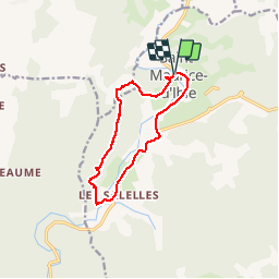
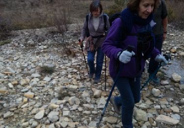
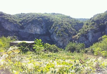
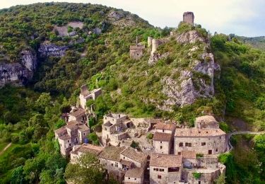
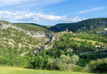
Trail Walking of 11.4 km to be discovered at Auvergne-Rhône-Alpes, Ardèche, Saint-Maurice-d'Ibie. This trail is proposed by marquet.

Description

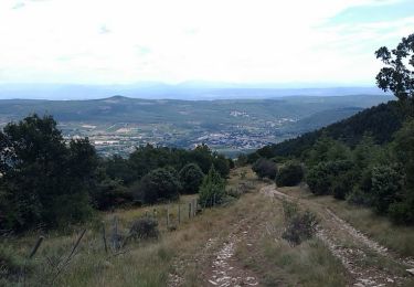
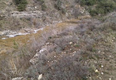
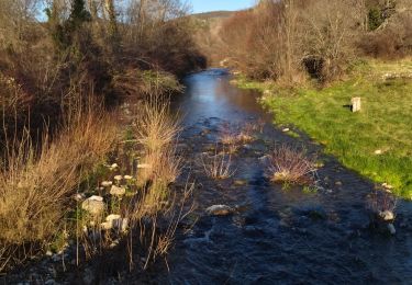
On domine la vallée de l'ibie.au dessus de Valos dire bonjour aux ânes et chevaux.ensuite suivre la crête et redescendre sur les Salettes,visiter le village.nous sommes revenu par la route pour raccourcir mais suivre les flèches qui en 8.9km vous ramènerons à St. Maurice.

Elevation profile

Positioning

Country:
France
Region :
Auvergne-Rhône-Alpes
Department/Province :
Ardèche
Municipality :
Saint-Maurice-d'Ibie
Location:
Unknown
Start:(UTM)
617840 ; 4928543 (31T) N.

Trails nearby

Trail Mountain bike Saint-Andéol-de-Berg - Les hauteurs de St Andéol de Berg - Photo
Mountain bike
tracegps

Mountain bike

Difficult
(2)
Saint-Andéol-de-Berg, Auvergne-Rhône-Alpes, Ardèche, France
29 km | 39 km-effort
3h 0min
Yes
Trail Walking Rochecolombe - 07 rochecompmbe gour sompe - Photo
Walking
himba26100

Walking

Medium
Rochecolombe, Auvergne-Rhône-Alpes, Ardèche, France
17 km | 23 km-effort
6h 22min
Yes
Trail Walking Saint-Maurice-d'Ibie - 07 st Maurice d ibis a revoir - Photo
Walking
himba26100

Walking

Medium
Saint-Maurice-d'Ibie, Auvergne-Rhône-Alpes, Ardèche, France
14.9 km | 21 km-effort
5h 24min
No
Trail Walking Rochecolombe - rando autour de rochecolombe - Photo
Walking
pilou38

Walking

Easy
(1)
Rochecolombe, Auvergne-Rhône-Alpes, Ardèche, France
6.6 km | 10 km-effort
2h 46min
Yes
Trail Walking Rochecolombe - Rochecolombe - Photo
Walking
vaud

Walking

Medium
(1)
Rochecolombe, Auvergne-Rhône-Alpes, Ardèche, France
5.3 km | 7.8 km-effort
2h 56min
Yes
Trail Walking Lagorce - leyris - Photo
Walking
JDEL84

Walking

Medium
Lagorce, Auvergne-Rhône-Alpes, Ardèche, France
15.4 km | 21 km-effort
4h 31min
Yes
Trail Walking Rochecolombe - Rochecolombe - Photo
Walking
lpratz

Walking

Medium
Rochecolombe, Auvergne-Rhône-Alpes, Ardèche, France
6.2 km | 9 km-effort
2h 39min
Yes
Trail Walking Rochecolombe - 2023-04-22_21h08m05_Autour_de_Rochecolombe - Photo
Walking
chancha

Walking

Difficult
Rochecolombe, Auvergne-Rhône-Alpes, Ardèche, France
10.1 km | 15.2 km-effort
3h 27min
Yes
Trail Walking Rochecolombe - Sauveplantade 6km - Photo
Walking
chancha

Walking

Easy
Rochecolombe, Auvergne-Rhône-Alpes, Ardèche, France
6.2 km | 7.7 km-effort
1h 46min
Yes


Close
My subscriptions