


Sommet de l''Amarron

frizou83
User
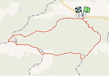

Length
11.5 km

Max alt
769 m

Uphill gradient
601 m
Km-Effort
19.5 km

Min alt
262 m

Downhill gradient
601 m
Boucle
Yes
Creation date :
2017-02-24 00:00:00.0
Updated on :
2017-02-24 00:00:00.0
4h11
Difficulty : Medium

FREE GPS app for hiking
 SityTrail
IGN / Geographical institutes
SityTrail Plus
The world is yours!
About
Trail Walking of 11.5 km to be discovered at Provence-Alpes-Côte d'Azur, Var, Brignoles. This trail is proposed by frizou83.
Description
Boucle vers le sommet de l''Amarron (770 m) pour admirer le panorama sur la montagne de la Loube


Positioning
Country:
France
Region :
Provence-Alpes-Côte d'Azur
Department/Province :
Var
Municipality :
Brignoles
Location:
Unknown
Start:(Dec)
Start:(UTM)
261659 ; 4807277 (32T) N.
Comments