


montcornet

michelelfn
User
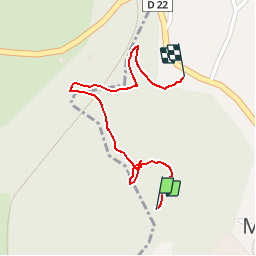

Length
711 m

Max alt
269 m

Uphill gradient
10 m
Km-Effort
851 m

Min alt
252 m

Downhill gradient
12 m
Boucle
No
Creation date :
2014-12-10 00:00:00.0
Updated on :
2014-12-10 00:00:00.0
10m
Difficulty : Very easy

FREE GPS app for hiking
 SityTrail
IGN / Geographical institutes
SityTrail Plus
The world is yours!
About
Trail Walking of 711 m to be discovered at Grand Est, Ardennes, Montcornet. This trail is proposed by michelelfn.
Description
montcornet
Positioning
Country:
France
Region :
Grand Est
Department/Province :
Ardennes
Municipality :
Montcornet
Location:
Unknown
Start:(Dec)
Start:(UTM)
616949 ; 5521082 (31U) N.
Comments